All Islands For Sale
50 of 67 listings

$13,000,000USD
Water Caye
Belize
Water Caye is one of the largest privately held islands in Belize, roughly 550 acres, twenty minutes by boat from Belize City, and positioned against the country's main deep-water shipping channel. That last fact is the whole thesis of the property. The southern edge of the island sits approximately 2,800 feet from the channel that brings cruise ships and commercial vessels into Belizean waters, which makes Water Caye one of the few private islands in the Caribbean genuinely suited to large-scale maritime, cruise, and marina development.
It is a commercial and development opportunity first, and a private island second.
---
## The Scale and the Position
At approximately 550 acres, Water Caye is not a boutique caye. It is a landmass, one of the largest islands available for purchase anywhere in the Caribbean, with roughly **4.4 miles of water frontage** and a network of natural canals threading the property. A canal has already been dug to allow cruise ships to approach the island directly.
The location is the asset:
- **2,800 feet from the main Deep Water Shipping Channel**, the route by which cruise ships and commercial vessels enter Belize
- **Approximately 12 miles from Belize City**, the country's largest population centre, which means construction materials, provisioning, labour, and guests are all close at hand, a significant advantage over the remote cayes of southern Belize
- **1.5 miles from the Belize Barrier Reef**, the second-largest barrier reef in the world and a UNESCO World Heritage system, with the reef's channel break only 2.8 miles away for direct blue-water access
- **Within an hour of Philip S. W. Goldson International Airport (BZE)**, the country's international gateway
The combination of scale, deep-water access, and proximity to both a major city and an international airport is genuinely rare. Most large Caribbean development sites are remote. Water Caye is not.
---
## The Existing Development
Approximately **10 acres of the island have been developed** and filled, originally operated as a day-resort serving the cruise lines: a facility capable of hosting large numbers of cruise passengers arriving by tender for a day on the island. The existing infrastructure includes:
- **A palapa**, described as the largest in Belizean waters, with a long central bar and extensive covered and open-air seating for dining
- **Two cottages and three cabanas**, providing overnight accommodation for up to eighteen guests
- **A commercial kitchen** and restaurant facility
- **A pier and docking facility** for berthing tender boats
- **Outdoor showers and restrooms** sized for day-visitor volumes
- **A pristine beach** along the developed frontage
The developed acres allow a new owner to generate income or host guests from the day of purchase, while the remaining acreage awaits the larger development.
---
## The Utilities
The island operates on established self-contained infrastructure:
- **A generator** for electricity
- **Water desalination equipment** and a **freshwater well**
- **Full plumbing** across the developed area
The presence of a functioning freshwater well on a Belizean caye is itself notable, and reduces the water-infrastructure burden that greenfield island developments carry.
---
## The Development Opportunity
Water Caye has attracted extensive development planning over the years, and a new owner inherits meaningful groundwork.
**Prior permissions, now lapsed.** The island was previously granted extensive development planning permission, covering building lots, hotels, villas, a deep-water marina, and an airstrip. Those permissions have since expired. A new owner would need to renew the lapsed permits, or apply for new permissions where applicable, but the precedent of the earlier approvals is a constructive starting point rather than a blank sheet.
**A completed Environmental Impact Assessment.** An EIA has already been completed for a previous development plan. For a project of this scale in Belize, an EIA is a substantial undertaking in both time and cost, and the existing assessment is available to qualified purchasers, potentially saving a new developer a significant portion of the pre-construction timeline.
The development directions that the island's scale and position support include:
- **A cruise port or terminal.** The proximity to the deep-water channel and the existing cruise-access canal make Water Caye one of the few private sites in Belize suited to a cruise-tourism facility, in a country whose cruise sector continues to grow.
- **A marina and yacht destination.** With 4.4 miles of water frontage, natural canals, and deep-water access, the island can support a large-scale marina for luxury yachts, superyachts, and commercial vessels.
- **A resort and residential development.** The acreage supports one or more hotels, resorts, and a subdivided residential community of luxury lots, with the developed 10 acres as an operating base during construction.
- **A championship golf course.** The scale allows for a full course, a use identified in the island's prior development proposals.
- **A mixed-use commercial village.** Retail, hospitality, and residential components combined, anchored by the cruise and marina infrastructure.
The realistic path is a phased, mixed-use development, using the existing 10 developed acres and the completed EIA as the running start, and building out the marina, cruise, resort, and residential components as demand and permitting allow.
---
## The Water
Water Caye's setting is the same Belize Barrier Reef system that anchors the country's tourism economy. The reef lies 1.5 miles to the east, with a rich marine ecosystem supporting snorkelling, diving, and sport fishing directly from the island. The channel break in the reef, 2.8 miles out, opens to blue water for deep-sea fishing and wall diving along the edge of the continental shelf.
For the eventual guests of whatever is built here, the water is the product: the clear Caribbean shallows for swimming off the beach, the reef for snorkelling and diving, and the deep water beyond for sport fishing. Belize's marine environment is the foundation of its tourism appeal, and Water Caye sits in the middle of it, minutes from the country's largest city.
---
## A Note on Belizean Ownership
Belize is one of the more accessible jurisdictions in the Caribbean for international buyers. **Foreign buyers can hold freehold title directly**, on the same terms as Belizean nationals, with no restrictions specific to foreign ownership of island or coastal property. English is the official language, the legal system is based on English common law, and the Belize dollar is pegged to the US dollar at a fixed rate, which removes currency risk for dollar-denominated buyers.
For a development of this scale, a buyer should engage a Belizean attorney experienced in large commercial and tourism projects, and should expect to work with the relevant national authorities on the renewal of permits, the updating of the Environmental Impact Assessment, and the tourism and maritime licensing that a cruise, marina, or resort development requires.
---
## Access
- **From Philip S. W. Goldson International Airport (BZE):** within approximately one hour, combining road to the Belize City waterfront and boat to the island; BZE receives direct flights from Miami, Houston, Dallas, Atlanta, Charlotte, Newark, Toronto, and several other North American and European gateways
- **From Belize City:** approximately 20 minutes by boat, roughly 12 miles
- **By sea:** direct deep-water access via the shipping channel 2,800 feet from the island's southern edge, with the existing cruise-access canal and pier
- **By air, future:** the island's prior development plans included a private airstrip, subject to permit renewal
---
## The Position
Water Caye is a development-scale opportunity of a kind that rarely comes to market in the Caribbean: roughly 550 acres of freehold island, against a deep-water shipping channel, twenty minutes from a capital city and within an hour of an international airport, with 4.4 miles of water frontage, an existing operating resort footprint, a functioning freshwater well, a completed Environmental Impact Assessment, and a history of granted development permissions to build from.
This is not a private-retreat purchase. It is a commercial and maritime development play, suited to a developer, an investment group, or a family office with a long-term thesis on Belizean and Caribbean tourism, cruise, and marina growth. For that buyer, the combination of scale, deep-water access, city proximity, and existing groundwork is close to unique in the region.
Whoever develops Water Caye is not buying an island so much as the platform for one of Belize's next major destinations.
567 AcresFreehold
Listed 71 days ago
$20,000,000USD
Île de Caille
Grenadines Archipelago, Grenada
Isle de Caille, also known as Caille Island or Île de Caille, is a private island of roughly 155 acres in the Grenadines, about four miles off the northern coast of Grenada and fifteen minutes by boat from the mainland. Two gentle volcanic knolls anchor its eastern and western ends, with a green valley between them, three beaches along its shores, and the deep blue water of the passage between Grenada and Carriacou on every side.
It is mostly undeveloped, which is the point. For a buyer with a vision and the patience to realise it, Isle de Caille is a blank canvas in one of the most celebrated sailing regions in the world.
---
## The Land
The island runs roughly 1.2 kilometres by 880 metres, rising to about 80 feet at its two volcanic high points. The terrain is the gentle, green, and rocky profile of the Grenadines: dense vegetation across the interior, coconut palms, scattered fruit trees, and the black volcanic rock that marks the island's eastern shore and speaks to its geological origin.
- **Three beaches**, the largest around 350 metres of sand on the northern shore, facing the neighbouring island of Ronde, with the remaining coast mostly rocky and dotted with small protected bays
- **Two volcanic knolls** at the eastern and western ends, with a central valley between them, giving the island both elevated building sites with panoramic seascapes and sheltered lower ground
- **Black and white pebble shores** along the rockier margins, and the mixed blue-green water that gathers in the bays
The surrounding water is the island's recreational heart. The calm bays are ideal for snorkelling and scuba diving, and the wider passage offers excellent sailing and offshore fishing. **The Sisters**, a famous dive site of volcanic pinnacles 2.6 kilometres away, is visible from the island.
---
## The Existing Improvements
Isle de Caille is not raw ground. It carries the bones of earlier occupation, and a buyer inherits a meaningful head start on infrastructure, though each element requires work.
- **Five cottages**, positioned at height to overlook the Caribbean Sea and the neighbouring islands, each requiring full restoration or rebuild to reach its potential as a residence or vacation rental
- **An older pier and a concrete jetty** on the western side, providing water access
- **A freshwater cistern** for rainwater harvesting, in need of reconditioning, with a flat concrete top that has in the past served as a landing pad for helicopters (there is no formal heliport)
- **A network of dirt roads and trails**, wide enough for an all-terrain vehicle, threading the island's interior and connecting the building sites to the beaches and the jetty
The realistic infrastructure plan for a new owner combines rainwater harvesting from a reconditioned cistern, or desalination, for fresh water, and generators with solar power for electricity. The island does not currently have running water, mains electricity, or paved roads, which a buyer should understand clearly. This is an undeveloped island with the foundations of past use, not a turnkey estate.
---
## The Development Opportunity
The gentle scale and the existing improvements make Isle de Caille a more approachable development proposition than the largest Grenadines islands, while still offering genuine scope. Credible directions include:
- **A private estate.** A principal residence on one of the volcanic knolls, with the restored cottages as guest accommodation, and the rest of the 155 acres held as private grounds and nature reserve.
- **A boutique hotel or villa resort.** The elevated sites, the three beaches, and the existing road network support a low-density luxury development in the manner of the leading Grenadines private-island resorts.
- **A vacation-rental operation.** The five cottages, fully restored or rebuilt, each with its own outlook over a different section of the island, could form the basis of an income-generating rental portfolio.
- **A mixed private-and-conservation holding.** A single residence with the majority of the island retained in its natural state, aligned with the ecological character of the wider Grenadines.
The island's own materials note that development might include a luxury hotel, villas, private estates, a marina, and more. The scale is generous enough to combine several of these on different parts of the island.
---
## The Setting
Isle de Caille sits in the **Grenadines**, the chain of islands running north from Grenada toward St. Vincent that is widely regarded as one of the three or four finest sailing regions on earth. The island lies in the passage between Grenada and Carriacou, at the southern end of the archipelago.
Its immediate neighbour is **Ronde Island**, less than 350 metres to the north, the largest privately held island in the Grenadines. Beyond, the archipelago opens toward the **Tobago Cays**, **Mustique**, **Petit St. Vincent**, **Palm Island**, and the other celebrated islands of the chain, all reachable by yacht. The wider region is under consideration for UNESCO World Heritage status across both the Grenada and St. Vincent jurisdictions.
**Grenada**, the main island four miles south, is among the most cultivated and historically rich of the Caribbean nations, known as the **Spice Isle** for its nutmeg, cinnamon, clove, and cocoa. The restored colonial capital of St. George's, the Port Louis marina, the rainforests and waterfalls of Grand Etang National Park, and a rum and cuisine culture that has drawn slow international attention over the past decade all lie within reach. The fishing town of **Sauteurs**, on Grenada's northern coast and visible from Isle de Caille, is the closest mainland settlement.
---
## A Note on Grenadian Ownership
Grenada welcomes international buyers, with **direct freehold purchase** available to foreign nationals. The country's **Citizenship by Investment programme** offers an additional pathway, granting Grenadian citizenship to qualifying investors in approved real estate, which for a buyer of a property at this scale can be a meaningful complement to the acquisition.
A licensed Grenadian attorney should structure the transaction and confirm the surveyed acreage, the title, and any development consents required for the buyer's intended use.
---
## Access
- **From Maurice Bishop International Airport (GND), Grenada:** direct flights from London (Gatwick), New York, Miami, Atlanta, Toronto, and Frankfurt, then road to a northern Grenada boat dock
- **From the Grenada mainland to Isle de Caille:** approximately 15 minutes by boat, roughly 4 miles
- **By private yacht:** the island's bays offer anchorage, with the older pier and jetty on the western side for tender access
- **By helicopter:** the island has accommodated helicopter landings on the cistern pad in the past, subject to restoration and arrangement
---
## The Position
Isle de Caille is a rare and approachable entry into Grenadines private-island ownership: roughly 155 acres of gentle volcanic island, three beaches, five restorable cottages, existing water and road infrastructure to build from, and a position at the heart of one of the world's premier sailing archipelagos, next door to the largest private island in the Grenadines.
For a visionary buyer prepared to restore rather than to arrive at a finished estate, Isle de Caille offers the elusive combination that the Eastern Caribbean rarely presents: a genuine private island, in a thriving and culturally rich country, at a gentler scale than the region's trophy properties, ready to become whatever its next owner imagines.
55 AcresFreehold
Listed 71 days ago

$4,000,000USD
16.46972,-88.2968401
Placencia, Belize
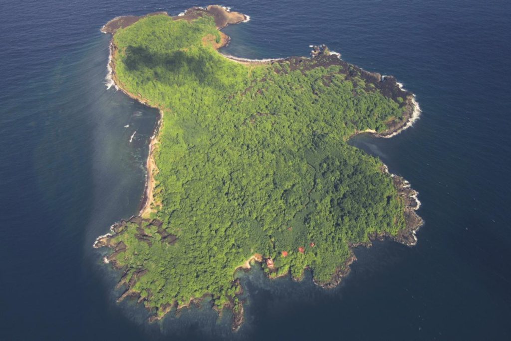
Comprising just 4 acres of tropical vegetation together with pristine, sandy beaches off the southern tip of Placencia, Zama Caye combines luxury with intimacy in this extraordinary resort opportunity. The exceptionally clear, Caribbean waters boast spectacular coral and marine life, ideal for diving and snorkelling. Mouth-watering lobster and seafood await lucky guests keen on fishing for their own catch of the day. Existing facilities on Zama Caye include the ‘Paradiso Grill’ (complete with a 48” wood-fired pizza oven and large BBQ grill), a one-bedroom, island-chic casita, outdoor guest bathroom and staff accommodation. Utilities are provided by a diesel powered generator, rainwater storage and septic system. Opportunities for further resort development abound, with proposals for 18 over-water units featuring individual plunge pools, restaurant and grill, water-sports centre, activity beach, pool and spa. With such close proximity to the mainland, Zama Caye makes minimal demands for storage capacity and staff accommodation.
4 AcresFreehold
Listed 71 days ago

$7,500,000USD
West Nalaut Island, Busuanga, Palawan
Busuanga, Palawan, Philippines
Also known as West Nalaut, Dao Island spans 47.9 hectares and is located off the west coast of Busuanga Island – the second largest body of land within Palawan province. Dao is an exceptional property for several reasons. Foremost, Dao is the only known island within the Palawan province with a clear title suitable for commercial development – other private islands within the region frequently contend with underlying indigenous claims. Ownership rights aside, the property boasts an inspiring roster of features: a primary sand beach, several beach coves, 80-metre cliffs in some sections of the three-kilometre coastline, dense interior rainforest coverage, ample wildlife, and a surrounding coral reef. Undeveloped and brimming with paradisiacal attractions, Dao Island exhibits abundant potential as a tourist resort or private retreat.
118 AcresLeasehold
Listed 71 days ago

$6,000,000USD
Urelapa
Espiritu Santo, Vanuatu
In December 2003, a team of international scientists surveyed the coral reef surrounding Urelapa Island and reconstructed 23,000 years of its history. What they found in the fossil reef was a record of **17,000 years of continuous coral growth**, the longest such unbroken sequence ever studied anywhere in the world.
That reef still fringes the island. Urelapa is roughly 140 acres of undeveloped South Pacific island, twelve minutes by boat from the coast of Espiritu Santo in Vanuatu, with more than a kilometre of white sand beaches, a four-hectare freshwater lagoon, a former airstrip, and a coral reef of documented global scientific significance.
It is available as a whole island, or subdivided into as many as ten parcels.
---
## The Land
The island measures approximately **1.7 kilometres long by 700 metres wide**, with a landscape of lush tropical vegetation, calm coastal waters on one side and surf on the other, and the fringing reef that gives the island its scientific distinction.
- **More than 1,000 metres of white sandy beach**
- **A four-hectare inland freshwater lagoon**, fed by natural springs, with the size and shelter to support a private marina if a channel to the sea were cut
- **Deep-water access and mooring possibilities** around the island's perimeter
- **An 800-metre former grass airstrip**, which is currently overgrown and not usable, and which would need to be cleared and restored to receive light aircraft
- **Natural spring water supply**, a genuine rarity on small Pacific islands and one that removes the desalination burden that most island developments carry
The reef around the island is pristine and rich in marine life, and the combination of calm swimming water, surf, and reef makes Urelapa unusually versatile for a property of its size.
---
## The Reef
The coral reef is the island's most distinctive asset, and it is worth understanding precisely why.
The 2003 scientific expedition that surveyed Urelapa's reef was able to read 23,000 years of geological history in the fossil coral, and within that record identified an unbroken 17,000-year sequence of continuous growth. No longer continuous coral growth sequence has been documented anywhere on earth.
For a developer, this is more than a curiosity. A property whose reef carries a documented world record in coral science is a property with a genuine, defensible story for a conservation-led or research-partnered development, the kind of positioning that the high end of the eco-tourism market increasingly demands and rarely finds.
---
## The Development Opportunity
Urelapa is completely undeveloped. There is no concrete on the island. What exists is the raw material: the beaches, the lagoon, the reef, the airstrip footprint, and the spring water.
A preliminary resort and marina concept has been prepared for the island, and the flexibility of the offering is unusual:
**As a whole island.** A single buyer can take all 140 acres for a boutique eco-resort, a private estate, or an integrated resort-and-marina development anchored on the freshwater lagoon.
**As up to ten parcels.** The island can be subdivided, allowing a developer to sell individual lots to private buyers within a master-planned exclusive retreat, or allowing a group of buyers to acquire adjoining parcels together.
The realistic development directions include:
- **A boutique eco-resort**, positioned around the reef, the conservation story, and the low-impact character of the island
- **A marina development**, using the four-hectare lagoon as a sheltered basin, with the deep-water access around the island for larger vessels
- **A private estate**, with the whole island as a single family's retreat
- **A subdivided exclusive residential retreat**, with up to ten private lots
- **A restored airstrip**, allowing light aircraft to fly directly to the island, which would transform the property's accessibility and its commercial potential
A smaller neighbouring island, **Tuvana** (8.8 hectares, roughly 22 acres), is also available separately. The pairing has an obvious logic: Urelapa as the development site, Tuvana as the owner's private residence a short boat ride away.
---
## The Setting
**Espiritu Santo** is the largest island in Vanuatu, and one of the most storied places in the South Pacific.
During the Second World War, the United States built one of its largest Pacific bases here, and the island's wartime legacy remains its defining attraction. The **SS President Coolidge**, a luxury liner turned troopship that struck a mine and sank in 1942, lies in the shallows off Santo and is considered one of the greatest and most accessible wreck dives in the world. **Million Dollar Point**, where the departing US military bulldozed vast quantities of equipment into the sea rather than ship it home, is a second celebrated dive site.
James A. Michener was stationed on Espiritu Santo during the war, and the island and its neighbours became the setting for **Tales of the South Pacific**, the Pulitzer-winning book that became the musical and film *South Pacific*. The mythical island of Bali Ha'i was drawn from the view across the water from Santo.
Beyond the wartime history, Santo offers **Champagne Beach**, regularly named among the finest beaches in the world, the celebrated **blue holes** of freshwater springs inland, and a largely undeveloped landscape of rainforest, cattle country, and traditional villages.
Vanuatu itself is an archipelago of 83 islands, positioned within short flying distance of the region's major markets: **two to three and a half hours from Australia and New Zealand**, and close to Nouméa and Fiji. It is one of the least-developed and least-visited island nations in the Pacific, which is precisely the argument for developing there now.
---
## A Note on Vanuatu Ownership and Tax
Two features of Vanuatu's legal and fiscal framework are essential for a buyer to understand.
**Land is held on leasehold, not freehold.** Under Vanuatu law, all land belongs ultimately to indigenous custom owners, and foreign parties acquire long-term leases rather than freehold title. Urelapa is offered under a **75-year Commercial Tourism Lease that commenced in November 2006**, leaving roughly fifty-five years of the current term. This is the standard structure for foreign-held development land in Vanuatu, and lease renewal and extension mechanisms exist, but a buyer should understand clearly that they are acquiring a leasehold interest with a defined term, not perpetual ownership.
**Vanuatu is a well-established low-tax jurisdiction.** The country levies no personal income tax, no capital gains tax, no inheritance tax, and no wealth tax. For a buyer structuring a long-term Pacific investment, the fiscal environment is among the most favourable in the region. Vanuatu also operates a citizenship-by-investment programme, which some buyers pair with property acquisition.
A licensed Vanuatu lawyer should review the lease, the custom-owner relationships, the remaining term, and the development consents required for the buyer's intended use before any commitment.
---
## Access
- **From Australia:** approximately 2 to 3.5 hours by air to Vanuatu, with direct flights from Brisbane, Sydney, and Melbourne
- **From New Zealand:** approximately 3 hours by air from Auckland
- **From Port Vila (the capital) to Santo-Pekoa International Airport (SON), Luganville:** a short domestic flight
- **From Santo-Pekoa International Airport to the island:** approximately 23 to 26 km, then a boat transfer
- **From the nearest mainland point:** approximately 2.5 km, a 12-minute boat ride
- **From Luganville town by boat:** approximately 35 minutes
- **By air, future:** the 800-metre airstrip, once cleared and restored, would allow light aircraft to land directly on the island
---
## The Position
Urelapa is a rare combination in the South Pacific: roughly 140 acres of entirely undeveloped island, with a kilometre of white sand, natural spring water, a four-hectare freshwater lagoon suited to a marina, an airstrip footprint, deep-water access, and a fringing coral reef that holds a documented world record in the science of reef growth. It sits twelve minutes off the coast of Vanuatu's largest and most storied island, within a few hours' flight of Australia and New Zealand, in a country with no income tax and no capital gains tax.
The offering is unusually flexible. A single buyer can take the whole island. A developer can subdivide into ten parcels. A family can pair it with the neighbouring island of Tuvana.
What it is not is a finished property. Urelapa is a development site, held on a long lease, in a country where the legal structure and the construction logistics both require serious professional guidance. For the buyer with the vision, the patience, and the right advisers, it is one of the most compelling undeveloped island opportunities available anywhere in the Pacific.
140 AcresLeasehold
Listed 71 days ago

Price On Request
Ilha do Bernardo, State of Rio de Janeiro
State of Rio de Janeiro, Angra dos Reis, Brazil
Bernado Island is one of Brazil’s finest. The property, accessible by both boat and helicopter, boasts valuable proximity to Rio de Janeiro and established development – a combination that primes it for commercial use. Bernado’s 21 acres contain housing developments and a restaurant business that operates on weekends. Furthermore, the property features beaches on its eastern and western flanks, a large boat pier, two helipads, and a church. These facilities could be adapted for use as a flourishing island resort. The price of the island also includes three boats. Prime real estate in Angra dos Reis is hard to come by. Subscribe to get updated with the latest islands for sale in Brazil
21 AcresFreehold
Listed 71 days ago

$9,000,000USD
Ilha do Cavaco
Angra dos Reis, State of Rio de Janeiro, Brazil
Ilha do Cavaco sits in the sheltered waters of Angra dos Reis, in the Cunhambebe district of Brazil's Costa Verde, among the 365 islands that have made this bay the most celebrated yachting and weekend-residence region in the country. The island is naturally well-protected, thickly grown with indigenous Atlantic Forest vegetation, and surrounded by the calm, clear water that makes the bay one of South America's most reliable swimming and snorkelling environments.
This listing covers a **2.59-acre turnkey estate** on the island, professionally designed, fully built, and configured for large family gatherings or rental operation from the day of transfer.
---
## The Estate
The built footprint is distributed across the property and connected by landscaped pathways:
- **A main house** with two suites, the principal residence
- **A double bungalow** with two further suites
- **Five additional cottages**, bringing the total accommodation to a scale suited for extended family use or a small rental operation
- **A sauna**
- **Multiple swimming pools** distributed through the grounds
- **A tennis court**
- **A boat deck** for arrivals, departures, and day-cruising in the bay
- **Helipad access** for direct helicopter arrival from Rio de Janeiro or São Paulo
- **Utility infrastructure** in place and operating
The configuration is the practical one for how Angra dos Reis properties actually get used: a principal household in the main house, guests and extended family distributed across the bungalow and cottages, and the shared amenities (the pools, the sauna, the tennis court) as the connective tissue of a long Brazilian summer weekend.
The estate's accommodation count also positions it naturally for **rental operation**. Angra dos Reis is one of the strongest luxury short-stay markets in Brazil, with the bay's mansions and island estates commanding significant daily rates through the December-to-March high season and the major Brazilian holiday calendar. A buyer acquiring the estate as an income property steps into an established market with proven demand.
---
## The Private Beach and the Water
The estate includes a **private sand beach**, with the gentle gradient and protected exposure that the sheltered side of the bay's islands enjoy. The surrounding waters are ideal for **snorkelling**, swimming, and the small-boat leisure that defines daily life in the bay. The marine life around the island's rocky margins includes turtles, rays, and the reef fish populations that the bay's protected status has preserved.
The boat deck gives the estate direct water access for tenders and day boats, with the marinas of Angra dos Reis town within easy reach for larger vessels and full marine services.
---
## The Setting
Angra dos Reis is the **most island-dense coastal region in Brazil**, with approximately 365 islands scattered across the bay. The municipality, together with neighbouring Paraty, sits within the broader region inscribed by UNESCO in 2019 as the **Paraty and Ilha Grande Culture and Biodiversity** World Heritage Site, recognising the combination of preserved Atlantic Forest, traditional cultural landscapes, and one of the most biodiverse coastal marine systems in the world.
The bay has been the preferred weekend and summer-house region for Rio de Janeiro's wealthiest families since the 19th century. The combination of sheltered deep water for yachts, protected beaches, the dramatic green wall of the Serra do Mar dropping straight into the sea, and the year-round mild climate has made Angra dos Reis one of the most consistently desirable private real estate markets in Latin America.
**Ilha do Cavaco** itself sits close to the mainland in the Cunhambebe district, with quick boat access to the city centre of Angra dos Reis for provisioning, restaurants, marina services, and the practical needs of a working estate. The island is an established address within the bay, with a settled character and the kind of mature vegetation and landscaping that newer developments cannot replicate.
---
## The Bay's Rhythm
The character of an Angra dos Reis estate is built around the water, the boats, and the social geography of the bay.
The yachting culture is the central activity. Boats move between the islands, between the marinas of Angra dos Reis town and Paraty, and out to **Ilha Grande**, the large preserved island of the bay with its hiking trails and the Lopes Mendes beach that is consistently ranked among Brazil's finest. The yacht clubs of Angra dos Reis are among the most prestigious in the country.
For the owner of the Cavaco estate, the rhythm of weekends and summer is the bay circuit: mornings on the private beach, afternoons on the water, lunches at neighbouring island estates or in town, tennis before sundown, and the closed-circuit Brazilian luxury social life that has continued in this bay for generations.
---
## Access
- **From Rio de Janeiro (GIG):** approximately 2 hours by car to Angra dos Reis, with international connections from Europe, North America, and most major South American capitals
- **From São Paulo (GRU):** approximately 4 hours by car, or under an hour by helicopter
- **By helicopter:** direct arrival via the island's helipad from Rio de Janeiro (45 minutes) or São Paulo (50 minutes)
- **From the Angra dos Reis mainland:** a short boat transfer to the estate's boat deck
A buyer leaving Rio de Janeiro in the morning is on the estate's beach by lunch.
---
## A Note on Brazilian Ownership
Brazil welcomes foreign buyers under straightforward property law, with **direct freehold acquisition** available to foreign individuals and entities on the same terms as Brazilian nationals, with limited exceptions for rural border-zone properties (none of which apply to Angra dos Reis coastal real estate).
A licensed Brazilian property lawyer should structure the transaction. The country's tax framework, the standard registration process through the cartório, and the working market for foreign-held coastal real estate in the Angra dos Reis region make this one of the more accessible Latin American jurisdictions for international acquisition.
---
## The Position
The Cavaco estate is the accessible entry into the Angra dos Reis island market: a fully built, professionally designed, turnkey property with nine suites of accommodation across a main house, bungalow, and five cottages, a private beach, a tennis court, multiple pools, and helicopter access, at a scale that a single family can operate and a price tier well below the bay's flagship island estates.
For the buyer who wants the Angra dos Reis life, the bay circuit, the beach mornings, the December-to-March season, without the operating weight of a flagship compound, this is the property sized to deliver it.
2.59 AcresFreehold
Listed 71 days ago

$12,000,000USD
Naviti Islands Private Island
Naviti Islands, Fiji
Adjacent islands located just off the northwest coast of the Fijian mainland. Both boast all the attributes of premier tropical real estate: stretches of white sand beaches, lush native vegetation that supports a diverse ecosystem of wildlife, shallow waters for bathing and leisure activities, access to deepwater for boating and transit, and a wealth of flat land for future construction. Though offered leasehold, there is a declared potential for development. The special use title spans 99 years and is classified for tourism development. Interested buyers can request copies of the lease and its parameters should they so wish. Separated by only a few hundred feet of turquoise lagoon, these properties hold a promising future for either personal leisure or commercial income – pending the appropriate authorisations.
12 AcresLeasehold
Listed 71 days ago

€17,000,000EUR
Isola Grande
Sicily, Italy
Isola Lunga, also known as Isola Grande, is the largest of the four islands of the **Stagnone Lagoon Nature Reserve** on Sicily's western coast, opposite the city of Marsala. It is a long, low landmass running roughly ten kilometres north to south, forming the natural barrier that creates the shallow protected waters of the Stagnone. Without Isola Lunga, the lagoon and the salt pans that depend on it would not exist.
This listing covers approximately **88 of the island's 120 hectares**.
---
## What Is For Sale
The 88 hectares offered comprise the substantial majority of the island's land area, although not its entirety. Other portions of Isola Lunga are held under separate ownership or commercial concession, including the working salt pans on the western shore and the strict-protection sections of the nature reserve.
The land for sale includes:
- **Twenty bedrooms and twenty bathrooms** across the existing ruined structures, requiring full restoration
- **A dirt road** running through the maritime pine forest that covers much of the island's interior
- **A private dock** with direct sea access on the lagoon side
- **The "Tahiti" beach**, a fine white sand beach on the island's east side, one of the most distinctive coastal features of the property
- Several smaller secondary buildings in varying states of preservation, distributed across the southern reaches of the island
The Italian planning framework for this kind of property is the *recupero* (recovery) approach, which permits the restoration of existing structures to residential or hospitality use within protected nature reserve contexts where new construction would otherwise be prohibited. With twenty existing rooms across the ruined buildings, the restoration potential is substantial.
---
## The Setting
The Stagnone Lagoon is one of the most distinctive coastal landscapes in Italy. Sicily's largest lagoon, designated as a nature reserve in 1984, with four islands within it of which Isola Lunga is the largest. The shallow protected waters between Isola Lunga and the Sicilian mainland have supported salt production for centuries, and the lagoon today is recognised both as an ecologically significant Mediterranean wetland and as a culturally significant historic agricultural landscape.
The island itself carries the characteristic landscape of a long Mediterranean barrier island: maritime pine forest covering much of the interior, halophytic vegetation along the lagoon margins, low scrub on the higher ground, and Mediterranean herbs filling the air with the particular dry-summer perfume of western Sicily. The wildlife is the bird life of the lagoon, including the **pink flamingos** for which the Stagnone is well known, alongside herons, egrets, and the migratory species that use the lagoon as a Mediterranean rest stop.
The southern portion of the island operates as a strict nature reserve. The remaining acreage is the cultivable land where the existing buildings sit and where any restoration project would centre.
---
## The Salt Operation, As a Neighbour
The active salt operation on the western coast of Isola Lunga is the defining current activity on the island, and it is important for a prospective buyer to understand exactly what it is.
The salt pans are owned and operated by **Sei Saline**, a Sicilian company that has run the Ettore and Infersa salt works on the island and the adjacent mainland for decades. Since 2005, the company has also operated a **Salt Resort on Isola Lunga itself**: a small hospitality operation with rooms, a restaurant, and the historic restored windmills, marketed as part of their Sicilian salt-tourism experience. The Salt Resort takes bookings, hosts guests, and forms part of the existing island economy.
This is not a sleepy commercial concession in the background. It is a working hospitality and agricultural business already operating on Isola Lunga, with its own dedicated team, branding, and guest flow. The salt pans, the windmills, and the Salt Resort footprint are not part of this 88-hectare offering.
For a buyer evaluating Isola Lunga, this fact pattern matters in two ways:
**As an asset.** The presence of a refined, established salt-tourism operation already on the island provides a working model for what high-end experiential hospitality looks like in this setting, validates the buyer demand for it, and offers a potential strategic partnership for the right kind of new ownership.
**As a competitive consideration.** A new development on the 88 hectares that positioned itself as a salt-and-wellness destination would directly overlap with Sei Saline's existing operation. A new development positioned around different ground (a private estate, a wine-and-agricultural project, a marine-and-cultural retreat, a kitesurfing-oriented offering) would complement rather than compete.
A buyer should understand the existing operation in detail before deciding on a development direction.
---
## What Could Be Built Here
Three positions are credible for a thoughtful next owner of these 88 hectares.
**A private estate.** Restoration of the existing structures into a primary residence with guest accommodation, retaining the remaining acreage as private nature reserve. The dirt road, the private dock, and the Tahiti beach all support a serious estate-scale residence with the architectural and emotional advantages of a near-uninhabited 10-kilometre Sicilian barrier island as the setting.
**A boutique hospitality concept differentiated from Sei Saline.** The 20-bedroom existing footprint, restored, could carry a refined boutique operation positioned around themes the existing Salt Resort does not occupy. The east-side Tahiti beach lends itself to a beach-and-pine-forest positioning. The lagoon's reputation as a major European kitesurfing destination supports a watersports-oriented positioning. The proximity to Marsala wine country, to the Phoenician archaeology at Mothia, and to the Greek temples of Selinunte supports a cultural-tourism positioning.
**A marine-and-agricultural estate.** The Marsala wine region surrounds this property. A vineyard establishment on the appropriate parts of the island, paired with a restored estate residence, would create a Sicilian agricultural property of unusual character: vineyard, sea access, and the cultural and natural reserve context of the Stagnone.
Any combination of these is supportable across the 88 hectares.
---
## The Wider Region
Isola Lunga sits in one of the most layered cultural and natural landscapes in Italy.
**Marsala**, four kilometres east on the Sicilian mainland, is the cultural and commercial anchor of the region. The city is internationally known for **Marsala wine**, one of Italy's most famous fortified wines, with DOC protection and a long export tradition.
**Mothia (Motya)**, a small neighbouring island to the east, is one of the most important Phoenician archaeological sites in Italy, with a substantial museum and significant surviving ruins.
**The Stagnone lagoon itself** is one of the world's premier **kitesurfing destinations**, with shallow flat water, constant winds, and international competitions held in the surrounding waters annually.
**Selinunte**, an hour south, holds one of the finest preserved Greek archaeological sites in the Mediterranean.
**Erice**, a medieval Norman hilltop town above Trapani, is within day-trip range to the north.
**Palermo**, the Sicilian capital, is 90 minutes east by car, with its UNESCO-recognised Arab-Norman architecture, the markets, the restaurants, and the international airport.
---
## A Note on Italian Ownership
Italy is a member of the European Union, and **EU citizens** purchase Italian property on the same terms as Italian nationals. **Non-EU buyers** are welcome to acquire Italian property subject to bilateral reciprocity rules with the buyer's home country, which apply to nearly all major economies.
For properties within a designated nature reserve such as the Riserva Naturale Orientata Isole dello Stagnone di Marsala, the standard Italian planning controls apply alongside additional environmental restrictions. New construction is generally prohibited. The path to development is through the **recupero** (recovery) framework, which permits restoration of existing structures to residential and hospitality use. The 20-bedroom existing footprint of this property is what makes the restoration path viable.
The **Italian Golden Visa** programme is available to qualifying non-EU investors and provides a residency pathway that pairs naturally with significant Italian property acquisition. A licensed Italian property lawyer with specific experience in Sicilian rural and protected-area transactions should structure any acquisition.
---
## Access
- **From Palermo Falcone Borsellino Airport (PMO):** approximately 90 minutes by car, with direct international flights from London, Paris, Frankfurt, Madrid, Munich, Vienna, and most major European hubs
- **From Trapani-Birgi Airport (TPS):** approximately 15 minutes by car, with seasonal direct flights from London, Paris, Brussels, Frankfurt, Eindhoven, and other northern European cities
- **From Marsala to the boat dock at San Teodoro:** approximately 10 minutes by car
- **From San Teodoro to Isola Lunga:** approximately 15 minutes by boat across the shallow Stagnone lagoon, with direct landing at the island's private dock
- **By private yacht:** the lagoon's shallow depth limits direct yacht access; the deep-water port of Marsala accommodates yachts of significant size, with onward tender transfer
---
## The Position
Isola Lunga is the kind of property that essentially does not come to the open market: a substantial Sicilian island, in one of Italy's most protected coastal nature reserves, with twenty rooms of existing ruined structures available for restoration under the recupero framework, a fine white sand beach on the east coast, a private dock with direct sea access, and a maritime pine forest interior.
It comes with the working salt operation of Sei Saline as a neighbour, not as a partner or a competitor by default, but as a defining piece of the island's identity that the next owner will need to understand and work with.
For a buyer with the patience for a long restoration project, the cultural literacy to appreciate what they would be stewarding, and the means to honour a Sicilian landscape that has supported human activity for centuries, Isola Lunga is a position that few properties anywhere in the Mediterranean can match.
217 AcresFreehold Island Parcel
Listed 71 days ago
$900,000USD
Grape Cay
Pearl Cays, Caribbean Coast of Nicaragua
The Pearl Cays are eighteen small islands scattered across the Caribbean shelf off the eastern coast of Nicaragua, 35 kilometres from the village of Pearl Lagoon. White sand beaches, coconut palms, calm shallow water, surrounding coral reefs. They are one of the least-developed island groups in the Caribbean, and one of the most ecologically significant. In 2010, with the Wildlife Conservation Society, the Nicaraguan government formally established the **Pearl Cays Wildlife Refuge**, covering 700 square kilometres of marine ecosystem and the eighteen cays themselves.
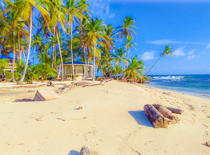
Grape Cay is one of those cays. 2.5 acres of private freehold land, currently offered for sale as a turnkey small-scale tourism operation.
## The Property
Two and a half acres of palm-shaded white sand at the eastern edge of the Pearl Cays group, surrounded by the calm shallow water and outlying reefs that protect the islands from the open Caribbean swell.
The existing improvements, completed during a recent seven-month renovation programme, include:
- A **circular cement main house** with an open-plan living area and fully equipped kitchen
- **Three round thatched cabanas** for guest accommodation
- A **fisherman-style structure** with zinc and palm-leaf roof, used as a beach shelter and equipment store
- A **bar and restaurant** building for the resident tourism operation
- A **workers' cabin** for staff accommodation
- All furnishings, fittings, and operational equipment
- A boat included in the sale
The property is offered as an operating business with the existing improvements, which means a new owner can take occupancy with immediate revenue potential rather than starting from raw ground.
## The Setting
The Pearl Cays sit inside one of the Caribbean's last genuinely undeveloped marine ecosystems. The surrounding waters are home to coral reefs, seagrass meadows, mangrove systems, and a marine fauna inventory that includes:
- **Critically endangered hawksbill turtles**, for which the Pearl Cays are the most important nesting site in Central America
- Green and loggerhead turtles, also nesting in the cays
- Manatees in the protected lagoon and mangrove waters
- Bottlenose dolphins
- Diverse reef fish, including grouper, snapper, jack, and barracuda
- Lobster, conch, and the artisanal fisheries that have sustained the coastal communities for centuries
The nesting season for hawksbills runs roughly May to November, and observation of the turtles, under guided and permitted protocols managed by the Wildlife Conservation Society and the autonomous regional government, is one of the area's defining ecotourism experiences.
The Caribbean coast of Nicaragua more broadly is the historic territory of the **Rama, Kriol, and Miskito** peoples, whose communities form the cultural fabric of the region. Their language, music (the distinctive Caribbean Coast palo de mayo and Garifuna traditions), and Afro-Caribbean and indigenous cuisine remain part of any extended visit to the area.
## What This Property Could Be
The current operating model is small-scale tourism: limited guests, fishing and snorkelling charters, the cabanas as accommodation, and meals at the on-island bar and restaurant. The 2.5-acre footprint and the surrounding wildlife refuge designation place hard ceilings on how much can be built here, which is appropriate to the site and the ecology.
Three directions are realistic for the next owner:
**Continue the existing operation,** retaining the cabanas, the staff, and the established customer flow as an immediately profitable small lodge.
**Convert to a fully private retreat,** decommissioning the commercial side and keeping the existing structures for personal and guest use.
**Reposition as a conservation-aligned ecotourism partnership,** working formally with the Wildlife Conservation Society or one of the Nicaraguan autonomous regional authorities to integrate the property with the wildlife refuge's protection programmes. Properties of this type, when run carefully, can become net contributors to conservation outcomes and command premium positioning in the responsible-tourism market.
## Due Diligence
The Pearl Cays sit inside the **Región Autónoma de la Costa Caribe Sur (RACCS)**, one of Nicaragua's two autonomous coastal regions, whose property law combines national title with indigenous communal land claims that are still being formally adjudicated for parts of the coast. Due diligence for this property includes:
- Verification of clean freehold title under Nicaraguan and RACCS law
- Confirmation that the existing improvements comply with Pearl Cays Wildlife Refuge environmental regulations and were permitted at construction
- Review of operating licences for the tourism business
- Independent environmental assessment of the property, particularly regarding the hawksbill turtle nesting beaches that are protected across the Pearl Cays generally
A licensed Nicaraguan property lawyer with specific experience in the autonomous coastal regions should review the title package before deposit. This is standard practice for any Caribbean coast Nicaragua transaction and is not specific to this property, but it matters more here than in most Caribbean jurisdictions because of the layered legal context.
## Access
- **From Managua (Nicaragua's capital):** by domestic flight to Bluefields (1 hour) or by road and river to Bluefields (approximately 6 hours via Rama)
- **From Bluefields to Pearl Lagoon village:** approximately 1 hour by panga (small motorboat) up the coast
- **From Pearl Lagoon to Grape Cay:** approximately 1 hour by boat across the Pearl Lagoon shelf, depending on conditions
- **Total journey from Managua to the island:** approximately 4 to 8 hours depending on transport choices
- **International flights:** Managua's Augusto C. Sandino International Airport serves direct routes from Miami, Houston, Atlanta, Panama City, San José, and Madrid
## The Position
Caribbean private islands of this size are reaching markets less and less frequently. The Pearl Cays remain one of the lowest-density and most ecologically intact island groups in the Caribbean, and freehold titles within the cays have historically been very rare. A buyer with a thoughtful position on the relationship between private ownership and ecosystem stewardship will find this property either a genuine opportunity or a significant responsibility, depending on how it is approached.
For full title documentation, the operating business package, and the environmental compliance file, inquire through Private Island Market.
2.5 AcresLeasehold
Listed 71 days ago

$11,000,000USD
Isla de Puercos
Balboa District, Isla del Rey, Panama
Part of the Pearl Islands, Isla Puerco commands a prime location within the Gulf of Panama – offering, not only, direct access to the neighbouring hub of Isla del Rey but also convenient access to the country’s capital. Puerco is a sizable investment, being both one of the largest islands on the Panamanian market and one of the most expensive (at $11,000,000). The property’s vast breadth contributes to its richness of landscape – sand beaches line Puerco’s shores while dense vegetation, abundant with wildlife, populates its interior.
160 AcresFreehold
Listed 71 days ago

$5,000,000USD
Bulhaaholhi
South Ari Atoll, Maldives
Bulhaaholhi is an uninhabited island in **Alifu Dhaalu Atoll**, the southern half of the great Ari Atoll archipelago, on the western edge of the Maldives. It sits ten minutes by speedboat from **Maamigili International Airport** and a twenty-minute seaplane flight from Velana International Airport at Malé.
The geographic position is genuinely distinctive. Maamigili, the inhabited island adjacent to Bulhaaholhi, is known internationally as **Whale Shark Island**. The waters of South Ari are one of only two places on earth where whale sharks are reliably present year-round, and the **South Ari Marine Protected Area** that surrounds the listing extends across the southern arc of the atoll.
For a buyer building a Maldivian resort around marine biodiversity, this is one of the most strategically positioned uninhabited islands currently available.
---
## The Setting
**Ari Atoll** is one of the largest natural atolls in the Maldives, covering approximately 267 square kilometres and comprising over 100 islands. It runs as the western pillar of the central Maldivian archipelago, opposite Malé Atoll and Vaavu Atoll, and has become one of the most established resort regions in the country. Over twenty resorts operate within Ari Atoll today, including Conrad Maldives Rangali Island, Velassaru, Mirihi, Diamonds Athuruga, Vakarufalhi, Lily Beach, and Kandolhu, among others.
Within Ari, the southern half (Alifu Dhaalu, also called South Ari Atoll) is the half closest to the whale shark migration corridor along the western edge of the atoll. The reef structure here drops steeply into deep water, which sustains the plankton blooms that feed the whale shark population. The same conditions support manta rays, reef sharks, eagle rays, and the deep marine biodiversity that has made Ari Atoll one of the most respected diving destinations in the Indian Ocean.
**Maamigili**, the local population centre and airport island, has a community of approximately 2,800 people and serves as the regional infrastructure hub. Domestic flights operate multiple times daily between Maamigili and Malé.
---
## The Listing Description
Per the listing agent's materials, the property offers:
- A **natural harbour** providing secure mooring for boats
- **Potential for yacht marina development** subject to Maldivian planning approvals
- **Space to accommodate overwater villa construction**, subject to lagoon survey and reef-impact assessment
- An undeveloped, virgin condition with no existing structures
Surveyed land area, lagoon dimensions, reef classification, and the full development brief are available through Private Island Market.
---
## What Could Be Built Here
Three positions are credible for a thoughtful next operator.
**A whale-shark-focused boutique resort.** The South Ari Marine Protected Area is the primary year-round whale shark site in the Maldives, and a small luxury resort positioned around marine biology, conservation, and direct dive access would have a position that no existing Ari Atoll resort can fully replicate. The proximity to Maamigili airport (ten minutes by speedboat) is significantly more convenient than the seaplane-only access that defines most remote Maldivian resorts.
**A mid-scale resort with strong air access.** Many established Maldivian resorts are constrained by seaplane-only access, which limits guest convenience, requires daylight operation, and adds a 30-to-90 minute transfer to most arrival schedules. A property ten minutes by speedboat from a domestic airport runway has a structurally easier guest experience, which translates to higher revenue per available villa and broader market reach. The "marina + overwater villa" framing in the agent's materials reflects this advantage.
**A private estate or family compound.** Maldivian leasehold structures permit private residential use under certain configurations, particularly when paired with a small staff and a limited-capacity hospitality licence. A buyer seeking a private Indian Ocean compound at Maldivian scale rather than a commercial resort would find Bulhaaholhi's position attractive.
---
## A Note on Maldivian Ownership
The Maldives operates a distinctive property framework that requires understanding before any transaction.
**Foreign buyers do not acquire freehold title to Maldivian land.** Foreign investment in resort islands and uninhabited islands is structured as a **long-term leasehold** from the Government of Maldives, traditionally for terms of 50 years, with provisions for extension. The Maldives has periodically conducted public auctions of uninhabited islands intended for tourism development, with minimum bid requirements and mandatory commitments to construct hotels of certain minimum capacities (typically 100 beds or more) under environmental impact rules.
**Private acquisitions outside the public auction process** are sometimes structured through Maldivian holding companies or through partnership with Maldivian entities, with foreign equity capped at a percentage that the Maldives Investment Authority approves on a case-by-case basis.
A buyer evaluating Bulhaaholhi should:
- Confirm the current legal status of the island (auction-released, privately held leasehold, or otherwise)
- Understand the lease term remaining and renewal mechanisms
- Engage the Maldives Investment Authority on foreign equity structure
- Commission an environmental impact assessment before committing to construction
A licensed Maldivian property and tourism lawyer should structure any transaction.
---
## Access
- **From Velana International Airport (MLE), Malé:** approximately 20 minutes by seaplane to Maamigili area; alternatively, 1 hour 30 minutes by speedboat
- **From Maamigili International Airport (VAM):** approximately 10 minutes by speedboat to Bulhaaholhi
- **International connections to Malé:** direct flights from London, Frankfurt, Munich, Dubai, Singapore, Bangkok, Beijing, Hong Kong, Seoul, Mumbai, and most major Asian and Middle Eastern hubs
- **Domestic connections to Maamigili:** multiple daily flights from Malé
The combination of domestic airport proximity (10 minutes) and international airport proximity (20 minutes by seaplane) gives Bulhaaholhi unusually strong dual-access for a Maldivian development site.
---
## The Position
Bulhaaholhi is an uninhabited island in one of the most established and most ecologically significant atolls in the Maldives, ten minutes from a regional airport, twenty minutes by seaplane from the international gateway, adjacent to the South Ari Marine Protected Area and the year-round whale shark habitat that has made South Ari one of the most respected marine destinations in the Indian Ocean.
For a buyer or development group with the resources to navigate the Maldivian leasehold and licensing framework, the operational vision to position a resort around the genuine marine assets of South Ari, and the patience for the multi-year development timeline that Maldivian projects require, Bulhaaholhi is a clear opportunity within a country that releases very few new development sites in the established atolls.
7 AcresLeasehold (50y)
Listed 71 days ago

$1,000,000USD
Lake Mälaren Private Island
Stockholm County, Drottningholm, Sweden
The Swedish Royal Family lives at **Drottningholm Palace**, on the island of Lovön in Lake Mälaren, 11 kilometres west of central Stockholm. The palace, the gardens, the 18th-century theatre, and the surrounding cultural landscape were inscribed by UNESCO as a **World Heritage Site in 1991**, the first Swedish site to receive that designation.
This listing covers a small private island in the same waters of Lake Mälaren, within sight of the palace and within the same geographic setting. The island carries a 58-square-metre holiday home, a guest cottage, a gazebo, docking platforms, and a small neighbouring island included in the sale.
It is one of the rare private islands anywhere in Europe where the cultural setting matters more than the acreage.
---
## The Position
The view from this island, on a clear day, includes the **Drottningholm Palace complex**, the official residence of King Carl XVI Gustaf and Queen Silvia of Sweden since 1981. The palace itself was commissioned in 1662 by Queen Hedvig Eleonora and designed by Nicodemus Tessin the Elder and his son Tessin the Younger, both of whom drew on the French royal architectural tradition of Versailles to create what has been called the Versailles of Sweden.
Beyond the palace, the wider Drottningholm cultural landscape includes:
- **The Drottningholm Palace Park**, modelled in the formal French and English landscape traditions of the 17th and 18th centuries
- **The Chinese Pavilion**, an 18th-century summer palace within the gardens, one of the most refined examples of the European chinoiserie aesthetic
- **The Drottningholm Palace Theatre**, an 18th-century court theatre with its original wooden stage machinery still operational, used for opera performances during the summer season
- **The UNESCO-inscribed cultural landscape** as a whole, which includes Lovön and the surrounding waterways
The relationship between the island and the palace is not symbolic. From the property's shoreline, the cultural ensemble is part of the daily view across the water.
---
## The Property
The island itself is intimate by design and complete by function. A buyer is acquiring:
- **A 58 m² holiday home**, the main residence on the island, configured for the contained living that a small private island makes possible
- **A guest cottage**, providing separate accommodation for visitors or family members
- **A gazebo**, the outdoor social space for the long Swedish summer evenings and the morning sun across the lake
- **Docking platforms**, providing direct boat access for arrivals, departures, and the daily rhythm of an island life on Lake Mälaren
- **A small neighbouring island**, included in the purchase, expanding the privacy buffer and the recreational footprint of the property
The 58 square metres of the principal residence is purposeful. Swedish summer-house architecture at this scale tends toward the well-considered: every square metre worked into a multi-functional life. The buyer of this property is not acquiring a sprawling estate; they are acquiring a beautifully positioned, perfectly sized retreat, with the additional asset of a separate small island held under the same title.
---
## Lake Mälaren
**Lake Mälaren** is Sweden's third-largest lake, covering 1,140 square kilometres and connecting Stockholm to the wider Swedish interior. The lake holds **over 1,000 islands**, many private, some inhabited, some preserved as nature reserves, others working farms and country estates. The Stockholm archipelago, with which Mälaren is connected via the city's central waterways, has been considered one of the world's premier sailing and small-boat regions for over a century.
The water of Lake Mälaren is fresh, warm enough in summer to reach 26°C, and clean enough to support strong populations of pike, perch, zander, and the freshwater fish that have anchored Swedish lakeside life for generations.
The boat journey from central Stockholm to Drottningholm, taken historically and still today on the working steamship **S/S Drottningholm** or the motor vessel **M/S Prins Carl Philip**, is one of the most distinctive arrivals in Stockholm. The same vessels pass within view of this island on their daily summer routes.
---
## The Access
The island sits **800 metres from the mainland shore**, accessible by private boat. The mainland approach is supported by community-shared parking and boat-mooring facilities, with the queue system that governs many Swedish island communities organising the slot allocation. These spots are part of the property's community-facility rights.
- **From central Stockholm:** approximately 30 to 40 minutes by car to the mainland boat dock, or a longer scenic journey by water through Lake Mälaren
- **From Stockholm-Bromma Airport (BMA):** approximately 6 kilometres southwest, with direct flights from European hubs
- **From Stockholm-Arlanda Airport (ARN):** approximately 50 km, with global connections including direct flights from New York, London, Frankfurt, Dubai, and most major European capitals
- **From Ekerö:** approximately 4 kilometres, with the nearest village amenities
The combination of direct city access (within the metropolitan boundary of Stockholm), proximity to two international airports (one of them 6 km away), and complete island privacy is rare anywhere in Europe and almost unique within the orbit of a national capital.
---
## What This Property Is For
The island is too small for a hotel, too small for a multi-villa compound, too small for a serious commercial operation. It is exactly the right size for what it is intended to be: **a private summer home with one of the most extraordinary cultural views in Europe**, accessible to a buyer who does not need to be a billionaire to acquire it.
For a buyer who has been thinking about owning a Swedish island but has found that most properties in the Stockholm orbit are either expensive country estates or remote archipelago summer houses without the cultural setting, this is the genuine alternative. A 58-square-metre holiday home, a guest cottage, a gazebo, docking platforms, and a second small island. All freehold. All within view of the home of the Swedish royal family.
---
## A Note on Swedish Ownership
Sweden is a member of the European Union, and **EU citizens** purchase Swedish property on the same terms as Swedish nationals. **Non-EU buyers** are welcome to acquire Swedish property under the country's open foreign ownership framework, with the standard transfer process handled through a Swedish notary and the local cadastre office.
Sweden's property law is among the most transparent in Europe. The land registry is digital, comprehensive, and publicly accessible. Title is unambiguous. The transaction process is fast by European standards.
Swedish residency does not flow automatically from property purchase, but a property in this position pairs naturally with the kind of seasonal or part-year residence that a non-Swedish buyer is likely to operate. A licensed Swedish property lawyer should structure any transaction.
---
## The Position
The island near Drottningholm is an unusual category of property: small enough to be accessible at a price point well below the trophy-island tier, with a cultural and geographic setting that the trophy-island tier itself struggles to match. The Swedish royal residence is on the next island. The UNESCO World Heritage Site is the daily view. Central Stockholm is a 30-minute drive or a scenic boat journey. Bromma Airport is 6 kilometres away.
For the buyer thinking about a Stockholm summer home that they can actually own as a private island rather than as a lakeside cottage, this is the position from which to do it. Most of Sweden's private islands sit hours from the cities and offer wilderness rather than cultural setting. This one is the inverse: in the city, on the lake, with the royal palace as the daily horizon.
0.3 AcresFreehold
Listed 71 days ago

$2,500,000USD
Double Island, Quezon, Palawan
Isugod, Quezon, Philippines
Double Island is a ~20-acre parcel of land that serves as a testament to the natural beauty of Palawan – the province is an exemplar of Philippine splendour and is consistently voted as one of the world’s finest island archipelagos. Double’s reflection of Palawan’s acclaim begins with its offering of immaculate, white-sand beaches. The island also comprises dense foliage coverage, shores rich with marine life, and several traditional beach residences. While easily accessed via the airport in Puerto Princesa, reaching the island is set to become even more streamlined with the budgeting of a new airport just two kilometres from Double’s transit pier. Investors can either purchase the island in its entirety or inject capital as part of a development partnership with the current ownership.
20 AcresLeasehold
Listed 71 days ago

€1,100,000EUR
Middle Calf Island
Roaringwater Bay, West Cork, Ireland
The school on Middle Calf Island was built in **1835**. It served the children of the six families who lived on the island and also took pupils from the neighbouring islands of West Calf, East Calf, and Cape Clear, who arrived by boat each morning. The population of Middle Calf in **1841**, the year before the Great Famine began, was thirty-nine.
The school closed eventually. The families left, one by one. **The last family departed in 1937**, after which the island has remained uninhabited.
Today, Middle Calf is a 64-acre uninhabited private island in the middle of Roaringwater Bay, off the coast of West Cork. The ruined walls of four dwellings, the outbuildings, the field divisions, and the school's stone foundations are still on the land. A herd of approximately twenty-five **Kerry Bog Ponies** grazes the island year-round, the only continuous inhabitants left.
---
## The Land
Sixty-four acres of West Cork coastal grassland, with the characteristic profile of a Roaringwater Bay island: rocky ocean margins, sheltered green interior, the stone walls of generations of small holdings dividing the land into fields that the ponies now graze across.
The shoreline carries **several beaches**, with the soft sand that the Atlantic edge of Ireland produces in its quieter coves. **Several small freshwater lakes** are dotted across the interior, supporting the year-round water supply for the ponies and the seabird populations that nest along the cliffs.
The buildings on the island are ruins, in varying states of preservation:
- **Four ruined dwellings**, the homes of the six families documented on the island in 1841 and through the late 19th century
- **Outbuildings** associated with the agricultural use, in similar condition
- **Stone walls** dividing the historic fields, mostly intact, marking the centuries-old subdivisions of the land
- **The remains of the 1835 school building**, with its specific historical significance to the wider Roaringwater Bay community
The island does not have a pier. Boats land at the beach, in the traditional manner.
---
## The Kerry Bog Ponies
The current population of the island is a herd of approximately **twenty-five Kerry Bog Ponies**, an endangered native Irish breed historically used to carry peat from Irish bogs back to the homesteads that burned it for fuel. The ponies are well-suited to the island's terrain: their small hooves cause minimal damage to grazed land, they thrive on the low-protein Atlantic grasses, and they survive Irish winters outdoors without supplementary shelter.
The herd's role on Middle Calf is dual. It maintains the grazed character of the land that the families' sheep and cattle once kept open. And it preserves a meaningful working population of a heritage breed that exists, globally, in very small numbers.
The herd is included with the property in the transaction, which is unusual in the private island market and reflects the operating ecological condition of the island.
In **2022**, a documented expedition led by Jeremy Irons and the Crowley family relocated six ponies from this herd to Mannin Island for breed-management purposes, a public moment that placed Middle Calf briefly into the wider Irish conservation conversation. The herd has remained a defining feature of the island's contemporary character.
---
## A Note in History
Roaringwater Bay was, in the 19th century, a site of one of the most significant tenant-rights political struggles in Irish history. The **Land War** of the 1880s and 1890s pitted Irish tenant farmers against absentee landlords across the country, and the islands of Roaringwater Bay were at the local centre of that struggle.
In September **1890**, **William O'Brien MP**, the founder of the National League and one of the most consequential figures in the Irish nationalist movement, held a political meeting on Middle Calf Island in support of tenants who had been evicted from the neighbouring Castle Island. The meeting was part of the broader campaign that eventually produced the Land Purchase Acts of the 1890s and 1900s, the legislation that transferred ownership of Irish land from landlords to tenants and laid the economic groundwork for Irish independence in the 20th century.
The visible heritage of Middle Calf, the school, the dwellings, the stone walls, sits at the centre of one of the most consequential periods in modern Irish political and social history.
---
## The Setting
**Roaringwater Bay** is part of **Carbery's Hundred Isles**, the West Cork archipelago of more than 100 small islands that has been one of the most distinctive coastal landscapes of southern Ireland for centuries. The bay opens to the Atlantic, with the protected interior waters running between Cape Clear (the southernmost inhabited point of Ireland), Sherkin Island, Heir Island, Castle Island, Horse Island, the Calves, and the Skeam islands.
The wider region is one of the most active private island markets in Europe. Recent neighbouring island transactions include:
- **Horse Island** (157 acres), reported sold in 2020 to Cypriot businessman John Renos
- **Castle Island** (123 acres), reported sold in 2020 to an English buyer based in France
- **West Calf Island**, the western sibling of Middle Calf, currently also on the private island market
The pattern of acquisitions reflects the underlying logic of West Cork's appeal: the combination of genuine Atlantic seclusion, the protected interior waters of the bay, the historic Irish coastal landscape, and the relative accessibility of West Cork by road from Cork City and air from Cork Airport.
**Schull**, the mainland village 5.7 kilometres north of the island, is one of West Cork's most refined small communities, with the Heron Gallery, the Sailing Cookery School, a Michelin Guide-recognised restaurant scene at Hackett's, Bushe's Bar, and the Schull Regatta in late summer. The village is the boat-arrival point for most of the Roaringwater Bay islands.
**Cape Clear Island**, 3.8 kilometres south, is Ireland's southernmost inhabited point, a Gaeltacht (Irish-speaking) community with the Bird Observatory, the Cape Clear Storytelling Festival, and the cultural depth that the most remote habitable parts of Ireland have always preserved.
---
## Development Considerations
The expired Outline Planning Permission for the reconstruction of a ruined dwelling, for use as a dwelling, and for the reconstruction of outbuildings for ancillary use, is a meaningful starting point but is no longer in force. **A new owner will need to renew the planning application** through Cork County Council, working within the Irish planning framework that governs heritage coastal sites.
This process is real, and a serious buyer should understand it. Irish planning for the reconstruction of historic structures on offshore islands typically requires:
- Engagement with Cork County Council planning department
- Archaeological assessment of the existing ruins
- Compliance with the Irish heritage protection framework where applicable
- A timeline that can run 12 to 24 months for a clean approval, longer for complex cases
That said, the precedent of the earlier outline permission is constructive. Cork County Council has, on the record, approved the principle of reconstructing a dwelling on the island. A renewed application that respects the heritage character and the modest scale of the existing footprint should follow a manageable path.
Three positions are credible for the next owner:
**A private retreat.** A reconstructed dwelling on the foundation of one of the four original homes, restored using stone consistent with the existing fabric, as the primary occupancy on the island. The herd remains. The island remains substantially in its current ecological condition.
**A heritage estate with conservation focus.** A more substantial restoration of multiple ruins, paired with a formal conservation management plan for the Kerry Bog Pony herd, the grassland, and the heritage structures. This is the position that aligns with the depth of cultural history the island carries.
**A continued working agricultural holding.** Without further building, the island can continue in its current use as a Kerry Bog Pony grazing operation, with the option to develop residential infrastructure deferred or declined entirely. For a buyer whose primary interest is the heritage and the herd rather than residential development, this is the lowest-touch option.
---
## A Note on Irish Ownership
Ireland is a member of the European Union, and **EU citizens** purchase Irish property on the same terms as Irish nationals. **Non-EU buyers** are welcome to acquire Irish property under the country's open foreign ownership framework, with the standard transfer process handled through an Irish solicitor and the Property Registration Authority.
Ireland's property law is among the most transparent in Europe. The land registry is digital and comprehensive. Title is unambiguous. The transaction process is straightforward by European standards. Irish residency does not flow automatically from property purchase, but a property at this scale pairs naturally with the kind of seasonal or part-year residence that an international buyer is likely to operate.
---
## Access
- **From Cork International Airport (ORK):** approximately 1 hour 45 minutes by car to Schull, with direct flights from London, Amsterdam, Paris, Frankfurt, Barcelona, and other European hubs
- **From Dublin Airport (DUB):** approximately 3 hours 30 minutes by car to Schull
- **From Shannon Airport (SNN):** approximately 2 hours 30 minutes by car
- **From Schull to the island:** approximately 5.7 kilometres by boat
- **From Cape Clear to the island:** approximately 3.8 kilometres by boat
- **From the West Calf Island anchorage:** 500 metres
A buyer flying into Cork in the morning is on the island by lunch.
---
## The Position
Middle Calf Island is the rare West Cork private island that combines genuine acreage (64 acres), a clean freehold title, complete privacy in one of Ireland's most beautiful coastal landscapes, and a layered cultural and ecological heritage that makes the property more than a piece of coastal land. The 1835 school, the four ruined homes of the six families who lived here until 1937, the herd of endangered Kerry Bog Ponies, and the 1890 Land War political meeting that linked this specific island to the chain of events that produced modern Ireland, give Middle Calf a depth of human and natural history that newer luxury private islands cannot replicate.
For a buyer with a thoughtful position on Irish heritage, on Atlantic conservation, or on simply owning a piece of West Cork at a scale that allows for meaningful long-term restoration, Middle Calf is the property where the work of the next century begins on foundations that the previous two centuries left ready to receive it.
64 AcresFreehold
Listed 71 days ago

Price On Request
Little Maosasnon Island
Busuanga, Palawan, Philippines
Discover an unparalleled jewel in Linapacan, Palawan, known as the most beautiful island in the region. Spanning 10 hectares, this breathtaking paradise in North Palawan is a haven of natural splendor, with features that make it a perfect candidate for a world-class resort. The island is adorned with Boracay-like white sand beaches, so pristine and luminous, they seem to glow with a crystal-like brilliance under the warm sun. This extraordinary landscape is complemented by a very long sand bar, reminiscent of the famed Snake Island in El Nido, Palawan, stretching gracefully into the azure waters. More than just its physical beauty, the island’s potential as a premier destination for an island resort is undeniable. Its expansive area, coupled with its stunning natural features, presents a rare opportunity for development into a luxurious escape, promising an exclusive and serene experience for visitors.
15 AcresLeasehold
Listed 71 days ago

€20,400,000EUR
Ceja
Medulin, Adriatic Sea, Croatia
The Istrian Peninsula is the corner of Croatia closest to Venice, and the bay of Medulin is the corner of Istria closest to the open Adriatic. Ten small islands sit scattered across that bay. Ceja, at forty acres, is the largest of them, and the only one currently for sale.
Pula, ten kilometres north-west, holds the sixth largest surviving Roman amphitheatre in the world, two thousand years old and still used for summer concerts. Brijuni National Park, a short cruise around the headland, was Marshal Tito's summer residence and hosted Khrushchev, Castro, Sophia Loren, and Elizabeth Taylor through the decades when it was the most exclusive address in the Mediterranean. The waters between them are some of the clearest in the Adriatic. This is the part of Croatia that the wealthy of Vienna, Milan, and Trieste have come to since the Habsburg era.
## What Ceja Is, and What It Could Be
Ceja is currently a working commercial island, not a private retreat. It is on the standard Medulin excursion-boat route, with daily public visitors arriving by water taxi and tour boat through the summer season. A 300-square-metre restaurant and bar operates on the island, serving lunches and drinks to those visitors. A smaller 40-square-metre residence, in need of renovation, sits elsewhere on the property.
This existing operation is, depending on the buyer's intention, either an asset or a starting point.
For a buyer interested in turning the island into a **fully private estate**, the existing infrastructure provides immediate occupancy and access points that would otherwise take years of permitting to build from scratch in Croatia. The public-visitation pattern is governed by the current ownership's hospitality licence and is not a structural fixture of the title.
For a buyer interested in a **boutique-hotel or exclusive-use rental conversion**, the foundations are stronger still: a commercial F&B operation in place, established water and boat access from Medulin, a built clientele who already know the island by name, and 25 acres of developable private land on which to build accommodation.
What the existing tour traffic confirms is the fundamental question every island development must answer: is there demand to come here? The answer at Ceja is already yes, several thousand times each summer.
## The Land
- **Total area:** approximately 40 acres (16 hectares), measured at 183,396 square metres of land mass
- **Coastline:** 1,643 metres
- **Private freehold:** 25 acres of the upland, available in this transaction
- **State-managed coastal zone:** 15 acres, comprising the foreshore and tidal land
The state-managed portion reflects Croatian property law rather than a limitation specific to Ceja. The narrow coastal strip below the high-water mark is state-owned across the entire Croatian coastline, and is leased or licensed to property owners for moorings, beach access, and adjacent uses. The 25 acres of private freehold are the entire usable upland of the island.
The island has several beaches, distributed around the coastline, including rocky swimming coves with the clear blue Adriatic water that has made Istria one of Europe's most travelled summer destinations. The lighthouse at Porer sits less than three nautical miles to the south, a working Austro-Hungarian-era beacon that anchors the seascape.
## Existing Buildings
- A **300-square-metre catering and hospitality building**, currently operating as a seasonal restaurant and bar
- A **40-square-metre residence**, requiring renovation to current standards
- Several smaller service structures associated with the hospitality operation
The condition of the residence and the precise placement of buildings between private and state-managed land are documented in the property's due-diligence file.
## The Setting
Medulin itself is a coastal town of around 6,500 residents that has quietly become one of Istria's preferred resort destinations, with the longest pebble beach in the region, a marina, the Bijeca sand beach, and a year-round community life. Three kilometres north of the island.
**Pula**, ten kilometres north-west, is the regional capital of Istria. The Roman amphitheatre is the headline, but Pula is also a working harbour with restaurants, museums, the Brijuni-bound ferries, and a wine and olive-oil culture that is now drawing the same sommeliers who have championed Istria's neighbouring regions for the past decade.
**Pula Airport** is seven kilometres north, with seasonal direct flights to London, Frankfurt, Vienna, Brussels, Stockholm, and most Eastern European capitals. From Vienna or Milan, the island is reachable for a long lunch.
**Cape Kamenjak Nature Park** sits at the southern tip of the peninsula, five minutes by boat from Ceja, with protected cliffs, sea caves, and the southernmost lighthouses of Istria.
**Brijuni National Park**, the former Tito residence and current presidential summer estate, lies twenty minutes by boat north of Pula. Tours run daily during the season.
## A Note on Ownership
Croatia welcomes foreign buyers under two different paths depending on nationality.
**EU and UK citizens** purchase Croatian property on the same terms as Croatian citizens, with no additional ministerial approval required.
**Non-EU buyers** have two routes. The first is direct purchase, which requires Ministry of Justice consent under Croatia's reciprocity rules with the buyer's home country, typically a two- to four-month process. The second is purchase through a Croatian company, available to citizens of any country and frequently the simpler route for commercial or development plans.
A Croatian property lawyer should advise on the appropriate structure before deposit.
## Access
- **By boat:** 800 metres from the Medulin shore, a five-minute crossing by private launch or tender
- **By car:** Medulin town centre is 3 km from the nearest mainland mooring
- **From Pula Airport:** 7 km north, a 10-minute drive
- **From Pula city centre:** 10 km north-west
- **From Trieste, Italy:** 2.5 hours by car
- **From Venice:** 4 hours by car or one hour by helicopter
## The Position for the Next Owner
Ceja is the largest island in Medulin Bay, and one of the few private islands of meaningful size still available on the Adriatic. The combination of existing infrastructure, commercial F&B operations already in place, proximity to two of Croatia's leading cultural destinations, and the underlying scarcity of forty-acre island freeholds in the Mediterranean make this a property with two distinct positions available to its next owner: a private estate carved out of an island that already welcomes visitors, or a refined hospitality concept built on foundations already laid.
The Adriatic has been one of the slowest-moving luxury markets in Europe through the past two decades, and Istria has been the slowest-moving region within it. Both are changing. Ceja sits at the inflection point.
40 AcresPart ownership (25 acres private ownership, 15 acres state ownership)
Listed 71 days ago

$2,500,000USD
Thatch caye
Dangriga, Belize
Nestled at the centre of Belize’s island resort region, and just a five minute boat ride from the large, barrier reef, South Cocoplum Caye is a glittering gem awaiting your discovery. Featuring 5.7 acres of white, sandy beach together with tropical palms overlooking crystal clear Caribbean waters, South Cocoplum Caye is perfect for a boutique hotel or intimate, private retreat. Just a twenty minute boat ride from the mainland, South Cocoplum offers accessibility coupled with privacy. Meanwhile, the island’s sister, North Cocoplum, is home to a successful resort, offering luxurious amenities just a short swim away. Other neighbouring resorts include Thatch Resort, Royal Belize, Salt Water Caye and Blue Marlin Lodge.
6 AcresFreehold
Listed 71 days ago

$250,000USD
Cheron Islets
Culion Island, Palawan, Philippines
The waters around Culion are the same waters around Coron. The same archipelago, the same limestone karst rising out of the same blue. The difference is how few people have heard of Culion, and how completely those waters have remained themselves as a result.
Culion was sealed off from the world for exactly one hundred years, from 1906 until the World Health Organization declared the island leprosy-free in 2006. A century of low development is rare on a tropical archipelago. The reefs survived it. The mangroves survived it. The light on the water in the late afternoon, when the sun drops behind the karst islands to the west, is what tropical light was before tourism found the tropics.
Today the local tourism office uses one official phrase to describe Culion: *Paradise Regained*. The town keeps a coral-rock church built in the 1700s from blocks of fossilised reef, a 1740 Spanish fort, and an archive inscribed on UNESCO's Memory of the World register. The bay holds Japanese WWII shipwrecks now overgrown with coral, ranked among the finest wreck dives in the world.
This listing covers two adjacent islets in those waters, near the well-known sandbar of Cheron Island, in the same bay as the overwater bungalows of Two Seasons Coron Island Resort.
## The Land
Two lots. One acre between them.
- **Lot A:** 2,360 sqm
- **Lot B:** 1,653 sqm
- **Combined:** 4,013 sqm
These are not large parcels. They are intimate ones, the size where a thoughtful house, a swimming dock, and a small garden are exactly enough, and where every step takes you closer to the water rather than further from it.
The water itself is the asset. Calamian water is the kind divers fly across continents to find: clear enough at noon to read a book through, warm year-round, and full of life. From your own dock you will see schools of needlefish in the shallows and, on still mornings, the silhouettes of the karst islands of Coron Bay rising in the distance like an unfinished sentence.
## What Surrounds You
**Two Seasons Coron Island Resort & Spa** sits in the same bay, with overwater bungalows, a private beach, and a full spa. Owners building on islands in this part of Palawan often use a resort like this as their base during construction, and as overflow for the kind of guests who want a proper bed within walking distance of the bar.
**Culion town** is a 30-minute speedboat ride away. The plaza, the coral-rock Immaculate Conception Church, the museum with its UNESCO-inscribed archives, the small market, the easy rhythm of a place that knows exactly what it is.
**Coron town** sits across the strait for shopping, restaurants, and onward connections.
**The reefs and lagoons** of Kayangan Lake, Twin Lagoons, Barracuda Lake, and the wrecks of Coron Bay are all within day-trip range of your own dock.
## Access
- **By air:** Manila or Cebu to Francisco B. Reyes Airport on Busuanga Island. Roughly 75 minutes from Manila, daily flights.
- **From the airport:** Van and boat transfer to Culion, then a smaller boat to the islets.
- **Once in the Calamians:** Boats are the road network, and a small private boat is part of the pleasure of an island home here.
---
The waters around Culion are the same waters around Coron. The difference, for now, is how few people have heard of Culion.
1 AcresLeasehold
Listed 71 days ago

$4,100,000USD
Ilha do Naná
Baía da Ribeira, Angra dos Reis, Brazil
Ilha do Naná, also marketed as Maná Island, sits in the **Baía da Ribeira**, the eastern arm of Angra dos Reis bay on Brazil's Costa Verde, two hours south of Rio de Janeiro. The property is one of the genuinely rare available freehold islands in what is widely considered the most celebrated yachting bay in the southern Atlantic.
The Brazilian Navy's official nautical charts identify the island at latitude 22°58'36.6"S, longitude 44°35'22.4"W. The position places Ilha do Naná closer to Mangaratiba than to the historic centre of Angra dos Reis itself, in the quieter and more refined eastern half of the bay, where the highest-value private islands of the region have concentrated for decades.
It is offered as a turnkey leisure property, with the existing development primed for immediate occupation.
---
## The Property
The existing built footprint is complete and configured for immediate residential use, with no significant construction required to bring the island into service.
- A **120 m² main house** as the primary residence
- **Four waterfront bungalows**, distributed along the shoreline
- A **separate caretaker's accommodation**, supporting year-round on-site management
- A **covered dining area and bar** adjacent to the bungalows, configured as the social heart of the property
- A **stone-carved freshwater pool**, cut into the natural rock of the island
- **Landscaped lawns** between the structures
- A **helipad** for direct helicopter arrivals from Rio de Janeiro, São Paulo, and the surrounding region
- **Solar power throughout**, with the island operating entirely off-grid
The property has been designed for the rhythm of an Angra dos Reis weekend household: arrival by helicopter or by boat from the mainland, accommodation distributed between a main house for the family and bungalows for guests, the covered dining area as the gathering point for long Brazilian lunches and dinners, and the pool as the centre of the daylight hours.
---
## The Setting
Angra dos Reis is the **most island-dense coastal region in Brazil**, with approximately **365 islands** scattered across the bay (a number that has earned the bay its informal description as having one island for every day of the year). The municipality, together with neighbouring Paraty, was inscribed in 2019 by UNESCO as the **Paraty and Ilha Grande Culture and Biodiversity** World Heritage Site, recognising the region's unique combination of preserved Atlantic Forest, traditional cultural landscapes, and one of the most biodiverse coastal marine systems in the world.
The wider Angra dos Reis coastline is protected by overlapping conservation designations:
- **Tamoios Environmental Protection Area** (21,400 hectares), covering all islands in the municipality
- **Ilha Grande State Park** (12,072 hectares), on the largest island in the bay
- **Praia do Sul Biological Reserve** (3,502 hectares), and the Aventureiro Sustainable Development Reserve
Together, these reserves protect 87% of Ilha Grande and significant portions of the surrounding mainland and islands, ensuring that the Costa Verde character of the region is durable rather than at risk of being overrun.
Within the bay itself, Angra dos Reis has been the preferred weekend and summer-house region for Rio de Janeiro's wealthiest families since the 19th century. The bay's combination of sheltered deep water for yachts, protected beaches, dramatic mountain backdrops dropping straight into the sea, and the year-round mild subtropical climate has made it one of the most consistently desirable private real estate markets in Latin America.
---
## The Bay's Rhythm
The character of an Angra dos Reis property is built around the **water**, the **boats**, and the **social geography of the bay**.
The bay's water is clear, calm in the protected channels, and warm enough year-round for unrestricted swimming. The surrounding **Mata Atlântica** (Atlantic Forest) provides the dramatic green backdrop that gives the Costa Verde its name, with the steep mountain wall of the Serra do Mar rising directly behind the islands.
The boating culture is the central activity. Yachts move between the islands, between the marinas of Angra dos Reis town and Paraty, and out to **Ilha Grande**, the large preserved island of the bay with its hiking trails and Lopes Mendes beach (consistently ranked among Brazil's finest). The yacht clubs of Angra dos Reis are among the most prestigious in Brazil, with the **Marina Verolme** and **Marina Porto Bracuhy** servicing the high-end fleet.
For the property's owner, the rhythm of weekends and summer is the boat circuit: lunches at neighbouring island estates, dinners on the mainland, day trips to the historic colonial town of **Paraty** (45 minutes by yacht to the west), and the closed-circuit Brazilian luxury social life that has continued in this bay for generations.
---
## Access
- **From Rio de Janeiro (GIG):** approximately 2 hours by car to Angra dos Reis, with international connections from Europe, North America, and most major South American capitals
- **From São Paulo (GRU):** approximately 4 hours by car, or under an hour by helicopter
- **By helicopter:** direct landing on the island's helipad from Rio de Janeiro (45 minutes) or São Paulo (50 minutes); helicopter charter is the standard arrival mode for the bay's high-end residents
- **From the mainland boat dock:** approximately 10 to 20 minutes by private launch, depending on the specific mainland departure point in Angra dos Reis or Mangaratiba
A buyer leaving Rio de Janeiro in the morning is on the island by lunch. A buyer leaving São Paulo by helicopter is on the island within the hour.
---
## A Note on Brazilian Ownership
Brazil welcomes foreign buyers under straightforward property law, with **direct freehold acquisition** available to foreign individuals and entities on the same terms as Brazilian nationals, with limited exceptions for rural border-zone properties (none of which apply to Angra dos Reis coastal real estate).
A licensed Brazilian property lawyer should structure the transaction. The country's tax framework, the standard registration process through the cartório, and the working market for foreign-held coastal real estate in the Angra dos Reis region make this one of the more accessible Latin American jurisdictions for international private island acquisition.
---
## The Position
Ilha do Naná is a turnkey private island in the most established and most prestigious yachting bay in Brazil, with a complete existing built footprint (main house, four waterfront bungalows, caretaker's residence, dining pavilion, pool, helipad), off-grid solar infrastructure, and the location two hours by car or under an hour by helicopter from both of South America's largest cities.
For a buyer looking to enter the Brazilian Costa Verde private-island market with immediate occupancy rather than a multi-year construction project, Ilha do Naná is the rare configuration where the property is ready and the bay is in front of you.
The Bay of Angra dos Reis has been the weekend home of Brazil's wealthy for a hundred and fifty years. Ilha do Naná is the way to acquire a piece of it.
15.4 AcresFreehold
Listed 71 days ago

$10,000,000USD
Roberts Cay
Exuma, Bahamas
Roberts Cay is a remarkable private island nestled in the northern Exuma Cays chain. Encompassing 12 acres of vibrant greenery, this idyllic island boasts two pristine white sandy beaches, a sheltered harbor, and an elevation of approximately 32 feet. Surrounded by crystal-clear turquoise waters, it’s a haven for snorkeling in the calm harbor and deep-sea fishing on the eastern side of the Cay. Situated roughly 28 miles southeast of Nassau, just half a mile south of Ship Channel Cay, and conveniently close to Norman’s and Highbourne Cay, Roberts Cay offers the perfect canvas to craft your own private paradise.
12 AcresFreehold
Listed 71 days ago

€2,200,000EUR
St. Athanasios Island
Corinthian Gulf, Greece
Itea, the small coastal town on the north shore of the **Gulf of Corinth**, sits 8 kilometres south of **Delphi**, the most important sacred site of the classical Greek world. For nearly a thousand years, the Oracle of Delphi spoke from the slopes of Mount Parnassos above this bay, and pilgrims from across the Mediterranean arrived by sea at the port of Kirra, immediately adjacent to modern Itea, before walking the sacred road inland to the temple of Apollo.
A short boat ride from Itea's shoreline, in the same water through which those pilgrims sailed, sits **St. Athanasios Island**.
The island is small, by design and by virtue. 10,811 square metres of private freehold ground, with the cultural and geographic context of one of the most consequential landscapes in European history at its doorstep.
---
## The Land
The island carries the classical Mediterranean character of central Greece: low, rocky margins where the land meets the Gulf of Corinth; an interior of **olive and pine trees** that has the dry-summer perfume that has defined Greek coastal landscapes since the Bronze Age; and a small **sandy beach** along the northwestern coast where the prevailing summer breeze keeps the air mild even in August.
The terrain is largely flat, which is unusual among small Greek islands and which is what makes the property practical for thoughtful residential development. The 250-square-metre family residence that the **pre-approved building permit** has authorised can be sited to take advantage of the morning sun over Mount Parnassos to the north, the evening light across the Gulf of Corinth to the south, and the small private beach as the gentle daily access point to the water.
The seawater is the clear, marine-life-rich water of the Gulf of Corinth, which has been one of the most productive marine ecosystems of the eastern Mediterranean for as long as human records have tracked it.
---
## The Cultural Context
Itea sits at the bottom of what was, for the better part of a millennium, the most important pilgrimage destination in the Mediterranean world.
**Delphi**, eight kilometres inland from Itea, was the seat of the **Oracle of Pythia**, the priestess through whom the god Apollo was believed to speak. From roughly the 8th century BC to the 4th century AD, Delphi was the **religious and political centre of the Greek world**. Greek city-states sent ambassadors to consult the Oracle before declaring war, founding colonies, or making major political decisions. The Pythian Games, second in prestige only to the Olympic Games of ancient Greece, were held at Delphi every four years. The site was inscribed by UNESCO as a World Heritage Site in 1987.
The temples, the treasury buildings, the theatre, the stadium, and the famous Sacred Way of Delphi survive today as one of the most photographed and visited classical sites in Greece. The slopes of **Mount Parnassos** rise directly behind Delphi, and the same slopes contain **the modern Parnassos ski resort**, one of the few in mainland Greece.
**Galaxidi**, a historic maritime port 15 minutes west by car from Itea, was one of the major Greek shipping towns of the 19th century and preserves its colourful neoclassical sea-captain mansions almost intact.
From St. Athanasios, looking inland to the north, the slopes that lead to Delphi are clearly visible. Looking south across the Gulf of Corinth, the mountainous coast of the Peloponnese forms the horizon. Looking west, the lights of Galaxidi mark the historic shipping town. Looking east, the bay opens toward the wider Corinthian Gulf and, beyond, the canal that connects to the Aegean.
This is one of the most culturally and visually layered private island positions available anywhere in Greece.
---
## What Makes This Property Specifically Buildable
For a Greek private island, the combination of features here is unusual and worth understanding individually.
**Full, unrestricted freehold title.** Many Greek private islands carry encumbrances, partial titles, contested ownership shares, or municipal-claim portions. St. Athanasios is held in clean unencumbered freehold, which is the simplest legal structure available under Greek property law and the structure most welcoming to foreign acquisition.
**Pre-approved building permit for a 250 sqm family residence.** Greek planning approvals for new construction on small islands have historically been slow, expensive, and uncertain. St. Athanasios already carries an approved permit for a substantial single-family residence of approximately 250 square metres. The buyer of this property is not starting the permitting process; they are stepping into a permit that has already cleared the relevant Greek authorities.
**Exemption from Natura 2000 area restrictions.** The European Union's Natura 2000 conservation network covers a significant portion of the Greek coastline and severely constrains development in many designated areas. St. Athanasios is **outside the Natura 2000 boundaries**, which means the residence permitted under the existing approval can be built without the additional environmental impact assessments that designated areas require.
**Forest certificate.** Greek properties with significant tree cover often face complications under the country's forestry law, which can restrict the felling of native trees and the siting of buildings. St. Athanasios carries a forest certificate that has resolved the relevant classification questions.
The combined effect of these four conditions is unusual in the Greek private island market. Many small Greek islands look approachable on first read but reveal complications during due diligence that extend a project's timeline by years or block it entirely. St. Athanasios is the rare small Greek island where the legal and regulatory groundwork has already been done.
---
## What This Island Is For
The size of St. Athanasios is the defining feature of its usability, and worth thinking about directly rather than apologetically.
At 2.6 acres, the property is too small to support a hotel, a resort, or a multi-villa development. It is also exactly the right size for what it is intended to be: **a single family's private island residence**, with the 250 sqm permitted residence as the primary house, the surrounding land as private gardens and olive grove, the small beach as the family's swimming and boating access point, and the Gulf of Corinth as the daily horizon.
For a buyer who has been thinking about owning a Greek private island but has been deterred by the scale and cost of the larger trophy properties on the market, St. Athanasios is the more accessible alternative position: a private island in genuinely exceptional geographic and cultural surroundings, sized to a household rather than to a corporation, with the building approvals already in place.
---
## Access
- **From Athens (ATH):** approximately 2.5 hours by car west on the National Road, with international connections from every major European hub, plus New York, Dubai, Singapore, and Beijing
- **From Athens by helicopter:** approximately 45 minutes to the Itea waterfront
- **From Patras International Airport (PAR):** approximately 1.5 hours by car
- **From Araxos Airport (GPA):** approximately 92 km by road, seasonal European flights
- **From Itea waterfront to the island:** approximately 10 minutes by boat
- **By private yacht:** the Gulf of Corinth is fully navigable, with the Corinth Canal connecting to the Aegean Sea to the east; Itea is a standard stop on the Athens-to-Ionian sailing route
A buyer flying into Athens in the morning is on the island by lunch.
---
## A Note on Greek Ownership
Greece is a member of the European Union, and **EU citizens** purchase Greek property on the same terms as Greek nationals. **Non-EU buyers** are welcome to acquire Greek property subject to bilateral reciprocity rules with the buyer's home country, which apply to nearly all major economies.
For a property of this scale and with this preparation, the transaction structure is straightforward by Greek standards: notarial transfer through a Greek notary, registration with the local cadastre, and the standard tax treatment for Greek residential real estate.
The **Greek Golden Visa** programme is available to qualifying non-EU investors and provides a residency pathway that pairs naturally with significant Greek property acquisition. A licensed Greek property lawyer should structure any transaction.
---
## The Position
St. Athanasios is the rare Greek private island where the work has already been done. The freehold title is clean. The Natura 2000 exemption has been confirmed. The forest certificate is in hand. The building permit for a 250 sqm family residence is pre-approved. What remains for the next owner is the relatively pleasant work of choosing the architect, siting the house, and beginning construction on a private island at the foot of Delphi.
The Oracle's slopes are visible from the property. The Gulf of Corinth opens to the south. Galaxidi is 15 minutes west by boat. The ski resort of Parnassos is 45 minutes by car. Athens is 2.5 hours by road or 45 minutes by helicopter.
For the buyer thinking about a Greek family residence at the cultural and geographic heart of central Greece, this is the position from which to build it.
2.6 AcresFreehold
Listed 71 days ago

$13,000,000USD
Isla Aguja & Isla del Rey Land
Las Perlas Archipelago, Gulf of Panama
Isla del Rey, the largest island in Panama's Las Perlas Archipelago, is **larger than the island nation of Aruba**. The 1,500-hectare parcel on offer represents approximately 6 percent of this single island, with **18 kilometres of ocean frontage**, hilltops rising to 180 metres above sea level, and the kind of varied topography that comes only with sovereign-nation-scale acreage on a major Pacific island.
The sale also includes **Isla Aguja**, a 7.5-hectare standalone private island that sits in the protected bay adjacent to the main parcel, with one of the finest natural anchorages in the archipelago at its threshold.
Together, the two properties total **3,705 acres** of fully titled Panamanian freehold land, with a development master plan by **EDSA**, one of the world's leading landscape architecture firms, already prepared for 160 hectares of the offering.
---
## The Property
The combined property is large enough that describing it requires distinguishing between two assets.
**The Isla del Rey parcel** (1,500 hectares) is the dominant scale of the offering. Within its boundaries:
- **18 kilometres of ocean frontage**, varied between dramatic rocky outcroppings, dozens of private coves, and a continuous 1.5-kilometre stretch of white sand beach
- **Hilltops up to 180 metres** above sea level, providing panoramic Pacific views and developable building sites with the elevation advantage that most Caribbean and Pacific private islands cannot offer
- **Mangrove forests, primary tropical forest, creeks and natural springs**, with multiple sources of fresh water that are genuinely rare on Pacific islands at this latitude
- **Mangrove and tidal estuaries** along the protected northeastern coast, supporting the bird life and the breeding habitat that has made the wider archipelago a marine conservation focus
**Isla Aguja** (7.5 hectares) is a complete freehold standalone island, included in the transaction. It sits immediately adjacent to the natural anchorage on the Isla del Rey parcel, with its own private shoreline and its own undeveloped character.
The combination of the two properties means the buyer acquires both a large continental-scale parcel on one of Panama's most significant islands and a complete small private island in the same bay.
---
## The Natural Anchorage
The protected bay between Isla del Rey and Isla Aguja is one of the most distinctive operational features of the offering, and worth understanding directly.
The **anchorage maintains deep-water access even at low tide**, suitable for mega-yachts and large commercial vessels. This is genuinely rare in the Pacific island market, where many otherwise attractive properties become unusable for serious yachting during tidal swings. For a buyer with a vision involving private marina infrastructure, charter yacht reception, or simply the ability to bring a 50-metre vessel directly to the property, the deep-water natural harbour is the kind of feature that would be impossibly expensive to construct from scratch.
The bay is sheltered enough to function as a primary anchorage in most weather conditions, and is one of the operational anchors of the EDSA-designed master plan for the property.
---
## The EDSA Master Plan
A development master plan covering **160 hectares** of the offering has been prepared and is included with the sale. The plan was designed by **EDSA**, the American landscape architecture firm founded in 1960 with significant Caribbean and Latin American hospitality experience.
The plan identifies the appropriate positions on the property for several possible development directions, alone or in combination:
- A **luxury eco-resort** integrated with the natural topography and the conservation-significant ecosystems on the parcel
- A **private marina** anchored on the natural deep-water harbour, with associated marine services and small-boat infrastructure
- An **exclusive residential enclave**, with the developable ridge and coastal positions identified and sized for individual estate plots
- A **conservation reserve**, with the majority of the 1,500 hectares retained as protected nature reserve and only the 160-hectare planned area developed
The plan is a starting point rather than a constraint. A buyer with a different development thesis can use the work that has already been done as a baseline and develop a new concept, or proceed with EDSA's framework substantially intact. Either way, the planning groundwork that is included with the property represents significant work already done before the transaction completes.
---
## The Setting
**Las Perlas Archipelago**, also called the Pearl Islands, is one of the most ecologically and historically significant island groups in the Pacific Americas.
The archipelago was **named for the pearls** that have been harvested from its waters since the **16th century**, when **Vasco Núñez de Balboa** crossed the isthmus of Panama in 1513 and became the first European to view the Pacific Ocean. The pearls from Las Perlas, traded through Panama City and the colonial Spanish empire, included some of the most celebrated gems in European royal history. **La Peregrina**, one of the most famous pearls in the world, was found in Las Perlas in the 16th century and passed through the collections of Spanish queens, French royalty, and ultimately Elizabeth Taylor.
The archipelago has remained quiet and largely undeveloped through the modern era. **Contadora Island**, the most developed of the Pearl Islands, hosted the Shah of Iran during his 1979 exile and remains the small-resort and weekend-house destination for Panama City's elite. **Isla San José**, **Isla Mogo Mogo**, and several other islands in the chain have figured in international television and film production over the past two decades.
The waters of Las Perlas are part of the **humpback whale migratory corridor** for the eastern Pacific population, with whales passing through in significant numbers between July and October each year. The archipelago is one of the most reliable whale-watching destinations on the Pacific coast of the Americas.
Isla del Rey itself is the largest island in the archipelago, with several small fishing villages distributed around its coast, including **San Miguel**, the main settlement. The island is large enough to support multiple distinct development positions without competing for the same ground.
---
## Use Cases
The 1,500-hectare scale opens positions that almost no other private property in Panama or the broader Pacific region can support.
**A luxury eco-resort and marina development.** EDSA's master plan covers exactly this position: a low-density boutique luxury operation built around the natural anchorage, the protected reef ecosystems, the 1.5-kilometre white sand beach, and the migratory whale corridor. The scale supports a 30 to 50 villa property with significant marine infrastructure without compromising the surrounding nature reserve.
**A residential estate community.** The same 160 hectares can be subdivided into private estate parcels, each with its own ocean frontage, its own forested backdrop, and its own access to the shared deep-water marina. Panama's subdivision framework is well-established and supports this kind of development at scale.
**A private estate with conservation reserve.** A single ultra-luxury private compound on the elevated ridges, with the remaining 1,300+ hectares held as private nature reserve. This is the position that aligns most closely with the wider conservation character of Las Perlas and the increasingly important role of large private estates as biodiversity reserves in the global luxury market.
**A mixed-position development.** The 1,500 hectares is large enough to carry all three positions simultaneously, with appropriate physical separation, and Isla Aguja as a separate complete private island for the property's principal residence or for a special-use building.
Any combination is supportable.
---
## Access
- **From the United States or Europe to Panama City (Tocumen International, PTY):** direct flights from Miami (3 hours), Newark, Houston, Los Angeles, Madrid, Amsterdam, and most major Latin American capitals
- **From Panama City to the property by air:** approximately 25 to 40 minutes by light aircraft or helicopter, with the nearest airstrip on Isla del Rey itself approximately 11 kilometres from the property
- **From Panama City to the property by boat:** approximately 90 minutes by speedboat, or longer by yacht
- **By private yacht:** the natural deep-water anchorage between Isla del Rey and Isla Aguja accommodates yachts of significant size directly at the property
- **From Contadora Island:** approximately 25 km north, with the small Contadora resort and its onward connections
---
## A Note on Panamanian Ownership
Panama is one of the easiest jurisdictions in the world for international property ownership. **Foreign buyers can hold freehold title directly** under exactly the same terms as Panamanian citizens, with no nationality restrictions on residential or agricultural real estate outside the small coastal-strip and border-strip zones, neither of which affects this property.
The country uses the **US dollar** as legal currency, has a stable democratic government and a treaty-based relationship with the United States, and operates one of the world's leading expatriate ownership ecosystems through its **Friendly Nations Visa**, **Pensionado**, and **Qualified Investor** residency programmes. Panama's tax structure is territorial: foreign-source income is not taxed by Panama for non-resident foreigners. A licensed Panamanian property lawyer should structure the transaction.
For a development-scale project of this magnitude, Panama's regulatory framework is meaningfully more accommodating than most regional alternatives, with the standard Panamanian construction and tourism permitting timelines applying.
---
## The Position
The combination of Isla del Rey and Isla Aguja is the largest single private island offering currently available on the market in the Pacific Americas, with the scale, the natural deep-water harbour, the EDSA development planning, and the clean freehold title that this size of project requires to be viable.
It is also one of the rare offerings where the marketing brief's claim of "unprecedented investment opportunity with vast scope" is, on examination of the underlying facts, accurate rather than promotional. Isla del Rey is larger than Aruba. The 1,500-hectare parcel under offer is itself larger than many populated municipalities. The natural deep-water harbour is genuinely among the best in the archipelago. The EDSA master plan represents the kind of upfront planning work that ordinary acquisitions in this region do not include.
For a developer, a sovereign wealth fund, or a private buyer with a long-term position on Pacific Latin American hospitality and conservation, this is the property that does not have a comparable on the open market.
3,700 AcresFreehold
Listed 71 days ago

€1,750,000EUR
Isola delle Femmine
Gulf of Palermo, Sicily, Italy
Isola delle Femmine, the Island of the Women, is a small oval island in the Gulf of Palermo, off the northwestern coast of Sicily, that has belonged to the same aristocratic family since the 1600s. It is roughly 34 acres of sloping grassland and craggy limestone, rising to 35 metres at the foot of a ruined stone watchtower, surrounded by some of the clearest protected water in the Tyrrhenian Sea.
The family that has held it for four centuries is now offering it for sale.
The island is uninhabited, undeveloped but for the tower, and is a designated nature reserve at the centre of a marine protected area. This is not a resort-development opportunity. It is one of the rarest categories of property in the Mediterranean: a genuinely historic, ecologically protected private island, offered by the family that has stewarded it since before the Baroque, to a buyer who will steward it next.
---
## The Name
The island's name has attracted legend for centuries.
The story most often told is that thirteen Turkish maidens, cast adrift by their families as punishment for some transgression, were shipwrecked on the island and lived there alone for seven years, after which their remorseful relatives found them and founded a mainland town they named Capaci (from *cca paci*, "here, peace"), while the island took the name Isola delle Femmine, the Island of the Women.
The history is more prosaic and, in its way, more interesting. The name is almost certainly the product of a long linguistic Italianisation. The most credible scholarly readings trace it either to *Insula Euphemi*, after Euphemius, the 9th-century Byzantine governor of Sicily, or to the Arabic *fim* (mouth, or inlet), a description of the island's narrow tuna-trapping bay, which passed through Sicilian *fimi* and was eventually reanalysed as *fimmine*, women. A royal decree of 1176 under William II already refers to the island as *Fimi*.
Whichever origin is true, the name has carried its own ghost stories for generations, of a girl seen singing and dancing along the shore. The current owner is candid that these are just stories. They are, however, very old ones.
---
## The Tower
The centrepiece of the island is a **ruined coastal watchtower** on its highest ground, with a 360-degree view that reaches to the distant island of Ustica.
The tower is older than it first appears. The associated tuna fishery (*tonnara*) was documented as early as 1176, and the tower in its present form dates to a 15th-century rebuild, part of the network of coastal fortresses that defended Sicily against Saracen and Corsair raids between the 15th and 18th centuries. Built of tuff-stone blocks with walls close to two metres thick, it comprised a lower level that functioned as a rainwater cistern and an upper domed chamber for arms, provisions, and the garrison, topped by a parapet with gun ports.
Its ruin has a specific and recent cause. The tower was **heavily damaged during the Allied landing in Sicily in 1943**, as part of Operation Husky, the largest amphibious operation of the Second World War. After the war it was neither rebuilt nor maintained, and was for a time used by the US Navy as an outpost to patrol Sicily's northern coast. The decades of abandonment that followed brought it to its current state.
The tower **can be fully rebuilt**, respecting the original volume of the structure, subject to the approvals that its protected setting requires. Some original features survive, including an external loggia that would allow direct access to the first floor.
---
## The Deeper History
The tower is not the only history on the island. Isola delle Femmine has been used by human beings for well over two thousand years, and the traces remain.
- **Roman garum basins**: the stone and lime-mortar tanks in which the Romans prepared *garum*, the prized fermented fish sauce of the ancient Mediterranean, survive on the island
- **Ancient wells and cisterns** cut to collect and store rainwater
- **Roman anchors and relics** lie on the surrounding seabed, part of what makes the waters an archaeological as well as an ecological site
- Over **120 plant species**, including irises, mallow, and mandrake, across the grassland and cliffs
For a buyer with a cultural or philanthropic thesis, the layered antiquity of the island is the substance of its appeal, and the basis on which a restoration project would be assessed.
---
## What Can and Cannot Be Done Here
Candour serves a buyer better than promotion on a property like this.
Since 1997 the island has been a designated **nature reserve**, for which the Italian League for Bird Protection (LIPU) is the managing authority. It sits within the **Capo Gallo-Isola delle Femmine Marine Protected Area**, established in 2001 and covering more than 4,000 hectares of protected sea, divided into zones of graded protection. The European Union has recognised the site's importance, classifying it first as a Site of Community Importance and then as a Special Area of Conservation.
What this means in practice:
- **A resort is not possible.** The protective designations preclude commercial resort development. A buyer expecting to build villas for return on investment should look elsewhere.
- **Restoration of the tower is possible**, respecting its original volume and the naturalistic constraints of the reserve, in cooperation with the local and national heritage authorities.
- **The realistic end uses** are a private residence within the restored tower, an archaeological or cultural museum, a research or conservation facility, or simply the acquisition of the island as a preservation piece and private retreat.
- **Public funding may be available.** For a development program that respects the surrounding nature, a new owner may apply for tax incentives and funding from the European Union or the Italian Ministry of Culture, for a cultural and touristic project compliant with the environmental constraints.
The honest framing is the one the market itself has arrived at: this is not an investment that will generate a commercial return. It is a piece of protected Sicilian heritage, available to a buyer for whom stewardship, privacy, and history are the return.
---
## The Water
The waters around Isola delle Femmine are the island's living asset. The marine protected area is an elite diving and snorkelling destination, with translucent water, reef structures, and a marine ecosystem that includes lobsters, sea anemones, and *madrepora* stony coral. The seabed holds the Roman anchors and relics that make a dive here an encounter with antiquity as much as with marine life. The island is reachable even by non-professional divers, thanks to the clarity of the water and the shelter of the gulf.
The shores are made of tiny white pebbles, with one small sandy beach and a cove suitable for mooring a dinghy or a fishing boat. Wandering vessels caught in weather have used the island's inlets for shelter for centuries.
---
## The Setting
Isola delle Femmine lies just off the coast of the town of the same name, on the Tyrrhenian shore northwest of Palermo. The town is a working Sicilian fishing village turned modern seaside resort, with a sandy beach, a fishing harbour, and a seafront promenade of restaurants.
- **Palermo**, the Sicilian capital, is 19 km away, with its UNESCO-recognised Arab-Norman architecture, its markets, its opera house, and its restaurants
- **Monreale**, with its extraordinary Norman cathedral and Byzantine mosaics, is 21 km away
- **Palermo Falcone-Borsellino Airport** is 16 km away, approximately 15 minutes by road, with direct flights from London, Paris, Rome, Milan, Frankfurt, Madrid, and most major European hubs
The island is one of the most accessible private islands in the Mediterranean, a short boat crossing from a mainland with a major international airport 15 minutes away.
---
## The Position
Isola delle Femmine is a rare thing: a private Sicilian island with two thousand years of visible human history, a restorable medieval watchtower, Roman antiquities on the land and the seabed, and one of the clearest protected marine environments in the Tyrrhenian Sea, held by a single aristocratic family since the 1600s and offered now for the first time in generations.
It is not a property for a developer. The protective designations that make the island what it is also foreclose the resort economics that a buyer might imagine. It is instead a property for a specific and rare kind of buyer: one who wants to hold, restore, and steward a genuine piece of Mediterranean heritage, with the deep satisfaction that the role carries and the antiquity of the place as the reward.
The family has held it since before the Baroque. The next owner writes the next chapter of a very long story.
34 AcresFreehold
Listed 71 days ago

$5,000,000USD
Isla San Pedro
Chiriqui, Rio Chiriqui Nuevo, Panama
San Pedro Island is a tropical paradise waiting to be discovered. This stunningly beautiful island boasts endless beaches, a gentle surf, and a pleasant climate, surrounded by lush vegetation and the sound of the palms waving in the breeze. The island is home to a variety of wildlife, including monkeys, sea turtles, and a myriad of bird species. This flat island features its own tropical forest, with many species of indigenous plants and trees such as banana plants. Freshwater streams and drilled wells provide ample water supply. The island is located in the Gulf of Chiriquí, one of the world’s premier fishing locations for species like Black Marlin, Blue Marlin, Swordfish, Cubera Snapper, Yellowfin Tuna, and Wahoo. Spanning over 4,655 acres, the island is mostly a mixture of rich black dirt and sand, which allows for excellent drainage and the perfect environment for plant growth. San Pedro Island is currently only accessible by boat, making it an exclusive and private oasis.
4,655 AcresInformation upon request
Listed 71 days ago

$10,800,000USD
Isla Porcada, Quebrada de Piedra
Gulf of Chiriquí, Pacific Coast of Panama
Isla Porcada is 924 acres of working Pacific island, a substantial freehold property currently operating as a cattle and horse ranch, just off the coast of Panama's Chiriquí Province.
This is not the usual luxury island proposition. Most private islands for sale at this latitude are small, undeveloped, and presented as raw potential. Isla Porcada is the opposite: roughly 374 hectares with rolling pasture and forest, a central plateau, freshwater springs, a standing herd, working agricultural infrastructure, an owner's residence, a farm house, a caretaker's house, four staff buildings, and an overgrown private airstrip that could be reactivated with the proper authorisations.
It is a productive, lived-in property, and it is for sale.
## The Land
Approximately 374 hectares, divided between cultivated pasture, native tropical forest, the central plateau, and the coastal margins. Several beaches around the perimeter. The Pacific Ocean to the west, the rainforest-draped peaks of mainland Panama to the east.
Water is the rare property of this island. **A freshwater spring** rises on site, supplemented by abundant ground water, which is why the cattle and horse operation has worked here for generations. Most Pacific islands at this latitude require desalination or aggressive rainwater capture. Isla Porcada is one of the few that does not.
The terrain is varied enough to carry multiple distinct uses simultaneously. The lower pasture is what currently grazes the herd. The plateau holds the natural location for a high-elevation residence or the planned guest house, with the panoramic Pacific views that the elevation provides. The forested interior holds tropical hardwoods, native fauna, and the kind of low-development quiet that becomes rarer in this region every year. The coastline holds the working ranch dock and the beaches that a private estate or resort development would use.
## The Buildings
The existing built footprint is substantial for a working agricultural island:
- **The owner's residence**, the main private dwelling on the property
- A **farm house**, used for the cattle and horse operations
- A **caretaker's house**, with year-round on-site management
- **Four staff buildings**, accommodating the ranch's working team
- **Plans for an additional guest house** on the plateau, with the architectural and permit work already advanced
The island is **off-grid by design**, with electricity supplied by a reliable **solar power system** and battery storage. For a buyer prioritising resilience, energy independence, or carbon footprint, this is one of the cleaner-running large private islands in Central America. **Cell phone coverage is good**, so the working ranch has stayed connected without depending on mainland utility infrastructure.
## The Working Ranch
The cattle and horse operation is the property's defining current identity, and it is what gives the island its distinctive market position.
Working private island ranches are rare. Most large Pacific freehold islands of this scale have been left undeveloped or converted to monoculture. Isla Porcada has been operated as a productive agricultural property for an extended period, with an established herd, working corrals, cattle handling infrastructure, and the daily rhythm of a Latin American hacienda that happens to be surrounded by water.
For a buyer with equestrian interests, the property opens directly into the niche of **stud farms and breeding operations**, with a combination of complete privacy, established equine infrastructure, year-round pasture, and proximity to Latin America's growing polo and equestrian-tourism scene. Panama's equestrian community is small but well-connected to Colombia, Argentina, and the broader Latin American sporting calendar.
For a buyer simply attracted to the romance of an island ranch, the property is already operating, and the existing staff can continue under new ownership.
## Development Considerations
The 924-acre footprint is large enough to carry several distinct development positions simultaneously. Five directions are credible:
**A private estate.** A signature residence on the plateau with the planned guest house, the ranch retained as a working agricultural and lifestyle asset, and the remaining acreage held as a private nature reserve. The compound footprint occupies a small fraction of the land.
**A boutique luxury resort.** The island sits in the same waters as Isla Palenque, the Michelin Two-Key-rated resort 30 minutes south, which has demonstrated the market for refined boutique tourism in the Gulf of Chiriquí. Isla Porcada's scale could carry a low-density resort in the manner of the leading Costa Rican and Belizean luxury operations.
**An equestrian or stud farm.** The current use, refined and elevated. A serious luxury equestrian operation on a private Pacific island would be the only one of its kind globally.
**A subdivision development.** Subdivision is permitted on the property, which opens the path to a controlled-density luxury village or compound-community of private estate parcels with shared dock, airstrip, and conservation common areas. Subdivision in Panama's coastal real estate has well-established precedent.
**A golf-and-residence resort.** The island has been previously evaluated for golf course development, and the terrain and Pacific climate are well-suited to a course with associated residential lots. Latin American golf real estate has emerged as a serious asset class over the past decade.
Combinations of these positions can coexist on the property.
## The Setting
The Gulf of Chiriquí is one of Central America's most ecologically rich and least-developed marine regions, and one of the more interesting emerging luxury destinations in the Western Hemisphere.
**Coiba National Park**, immediately to the south, is a **UNESCO World Heritage Site** (inscribed 2005), one of the largest marine parks in the world, and one of the most important refuges in the Eastern Pacific for whale sharks, humpback whales (Northern and Southern Hemisphere populations both pass through), bottlenose dolphins, hammerhead sharks, sea turtles, and the kind of biodiversity inventory that has drawn marine biologists, dive operators, and conservation organisations from across the world. The park has been described as the *Galápagos of Central America*.
**Isla Palenque**, the Michelin Two-Key boutique resort 30 minutes south, is the regional reference point for high-end tourism, with eight casitas tucked into the forest, a six-bedroom Villa Estate, seven private beaches, and a culinary programme rooted in local ingredients. Its success has demonstrated the market for refined Gulf of Chiriquí tourism without crowding it.
**Boca Chica** is the small coastal village that serves the islands of the Gulf, the gateway to charter boats, fishing operations, and the regional dive industry.
**The city of David**, 45 minutes inland, is the regional capital of Chiriquí Province and the second-largest city in Panama, with full hospital services, supermarkets, restaurants, the regional airport (Enrique Malek), and the rapidly-growing expatriate community that has made Boquete and the wider Chiriquí highlands one of Latin America's leading retirement and lifestyle destinations.
**Boquete**, in the highlands above David, is one of the world's most celebrated specialty coffee regions, with farms producing some of the highest-priced single-origin lots at auction globally.
## Panama: The Country
Panama is one of the easiest jurisdictions in the world for international property ownership. **Foreign buyers can hold freehold title directly** under exactly the same terms as Panamanian citizens, with no nationality restrictions on residential or agricultural real estate outside the small coastal-strip and border-strip zones, neither of which affects this property.
The country uses the **US dollar** as legal currency, has a stable democratic government and a treaty-based relationship with the United States, and operates one of the world's leading expatriate ownership ecosystems through its **Friendly Nations Visa**, **Pensionado**, and **Qualified Investor** residency programmes. Panama's tax structure is territorial: foreign-source income is not taxed by Panama for non-resident foreigners. A licensed Panamanian property lawyer should structure the transaction.
For a North American or European buyer, Panama's combination of accessibility, currency stability, and ownership-friendliness is essentially unmatched in Latin America.
## Access
- **From the United States or Europe to Panama City (Tocumen International, PTY):** direct flights from Miami (3 hours), Newark, Houston, Los Angeles, Madrid, Amsterdam, and most major Latin American capitals
- **From Panama City to David (Enrique Malek Airport, DAV):** approximately 50 minutes by direct domestic flight, multiple daily departures on Copa Airlines
- **From David to the boat dock at Boca Chica:** approximately 45 minutes by car
- **From Boca Chica to Isla Porcada:** approximately 20 to 30 minutes by boat
- **By waterplane:** direct seaplane charter is available from David to the island's coast
- **The on-island airstrip:** currently overgrown, but reactivation is possible under the right authorisations, which would allow direct light-aircraft arrivals onto the property itself
A buyer flying into Panama City in the morning is on the island for sundown the same day.
## The Position
Isla Porcada is a rare category of property: a 924-acre freehold private island with substantial existing infrastructure, freshwater springs, off-grid solar power, an established working agricultural operation, an overgrown but reactivatable private airstrip, and the legal and structural foundations for five distinct development positions. It sits in one of Central America's most ecologically significant marine regions, adjacent to a UNESCO World Heritage Site, in a country whose ownership framework is genuinely friendly to international buyers.
For the buyer evaluating a serious Western Hemisphere private island acquisition, few comparable properties exist on the open market. The combination of scale, water, terrain, infrastructure, ranch operations, and legal accessibility is unusual to find together. When it does come up, it tends not to stay long.
924 AcresFreehold
Listed 71 days ago

$2,500,000USD
Exuma Private Island
Exuma, Bahamas
Nancy Skinner’s Cay is a private island gem located in the stunning Exuma Cays of The Bahamas. Located near Georgetown, the main town on Great Exuma, this island offers both easy access to mainland Exuma and privacy away from the more populated Exuma Cays. On the north side of the 38-acre cay, the future owners can enjoy an irregular shore and clear shallow waters that run deep with water channels. The south side offers a scenic slope down to a marl and mangrove swash. For the adventurous, there is a small yet prominent mouth cave that stands 12 feet (3.7 m) above the high-water mark. And if that’s not enough, at the northeast end of the cay lies a bluff where fresh water can be obtained. An added bonus, shallow water with a deep channel flows along the western portion of this cay and the cays to the south.
38 AcresFreehold
Listed 71 days ago

$1,795,000USD
17.4268053,-88.0686994
Belize District, Belize
Just 9 miles from Belize City and only 2.5 miles from the large barrier reef, Goring Bogue Caye offers abundant potential as a private retreat or exclusive resort destination. Surrounded by the crystal clear Caribbean, this gem of an island has been cleared, dredged and filled, with 6 acres offering accommodation for a range of possible development options. Teeming with coral life and tropical fish, the nearby barrier reef offers unbeatable opportunities for snorkelling, diving and fishing.
6 AcresFreehold
Listed 71 days ago

$7,400,000USD
Faadhoo
Lhaviyani Atoll, Maldives
Uninhabited and undeveloped, Faadhoo remains a pristine example of Maldivian natural beauty. The property spans approximately 30 acres and is located on the eastern flank of the Lhaviyani Atoll – an administrative division north of the archipelago nation’s capital. Having remained undeveloped, the island retains its diversity of habitat and environments – sand and stone shorelines demarcate much of the property’s perimeter whilst dense vegetation covers the interior. Faadhoo also boasts an interior lagoon isolated from the surrounding ocean. Again, Faadhoo’s location cannot be undervalued. Lhaviyani Atoll has become a hotspot for diving and aquatic activities. A private residence here, or the development of a commercial leisure complex, would grant uninhibited access to a world of leisure.
30 AcresInformation upon NDA
Listed 71 days ago

€180,000EUR
Myrholmen Private Island
Södermanland, Katrineholm Municipality, Sweden
Selma Lagerlöf called Sörmland *Sweden's pleasure garden*. From Myrholmen's docks, you understand why before your coffee cools.
The island sits in Djulösjön, the lake at the heart of a province that holds 400 lakes and as many castles. Across the water, the white facade of Stora Djulö Manor has stood since the 1720s, on grounds first recorded in 1334. Lagerlöf wrote that very view into *The Wonderful Adventures of Nils* as the *Beautiful Pleasure Garden*, where Nils Holgersson rested on his journey across Sweden. From your dock, you see what he saw.
## What Myrholmen Is
A small island. The name itself tells you so. *Holmen* means islet, and Myrholmen earns the word. You can walk its perimeter in minutes.
But small means intimate, not constrained. There are docks in three directions: east for morning light, south for the long Swedish afternoon, west for sunsets that linger past ten in June. Wherever the day puts you, the sun is there too.
## The Buildings
Four structures, each doing its job without apology.
**The main house** holds the master bedroom, with space for a double and a single bed, and the kitchen. The kitchen runs on gas: a stove, a fridge, and a freezer compartment, all powered without a wire to the mainland. Off-grid by design, not by compromise.
**The guest cottage** adds three more sleeping places. Six guests in total, with no one giving up a bed.
**The sauna** is wood-fired. The cool Nordic summer night demands it; the lake, three steps away, finishes the job. Swedes built an entire summer culture around this single ritual, and on Myrholmen you have it to yourself.
The fourth building houses a dry toilet, the unglamorous detail that makes a freshwater island work.
## The Setting
You are three kilometres from the centre of Katrineholm, and a short row from Stora Djulö Manor itself, which now operates a café, restaurant, and ice cream bar with outdoor seating along the same shore you wake up to. The Djulö canoe club shares that shoreline. So does the manor's medieval stable, now a folk museum, and a hostel run inside the old red estate buildings, the oldest dating from the 1600s.
Beyond Djulösjön lies all of Sörmland: roughly 400 manor houses (more than any other Swedish province), the 1,000-kilometre Sörmlandsleden hiking trail, deer and wild boar in the forests, and the white water-lily (the provincial flower) opening in the quieter bays of your own lake. The regional tourism board calls it *Stockholm Country Break*. It is the countryside that Stockholm itself escapes to.
## The Practicalities
- **Stockholm Central to Katrineholm:** 52 minutes by direct train, hourly service, every day of the year.
- **Skavsta Airport** is closer still, with flights to most of Europe.
- **Mainland easements:** three parking spaces and a private dock, so you and your guests reach the island the same way the original owners did.
- **Included in the sale:** a rowboat.
- **Utilities:** gas-fired appliances throughout; the island is off-grid by design.
The arithmetic is simple. You leave Stockholm after a Friday meeting, reach Katrineholm in under an hour, row across, and have your feet in the lake before the sun touches the pines.
## What You Are Buying
Not a mansion. Not a compound. A small island with everything a thoughtful Swedish family would build for a hundred summers, and nothing they would not.
Selma Lagerlöf was right about the pleasure garden. Myrholmen is the part she did not put in the book.
0.1 AcresFreehold
Listed 71 days ago

$3,200,000USD
Abaco Private Island
Abaco, Bahamas
Don’t miss this unique chance to own two private islands in the stunning Abaco Islands of the Bahamas: Armstrong and Pond Apple Cays. These pristine islands, spanning 62 acres, offer a tranquil and protected retreat. With seven picturesque sandy beaches, you’ll have your own private oasis to enjoy powdery white sands, crystal-clear waters, and the Caribbean sun. Plus, the natural boat basin is a dream for boaters, and multiple building sites offer endless possibilities.
62 AcresFreehold
Listed 71 days ago

$4,900,000USD
Iris Island Resort, Sulu Sea, Davao City, Davao del Sur
Palawan, Philippines
Iris Island Resort is a premier destination for travelers seeking an unforgettable vacation. Situated on a stunning private island, this resort offers breathtaking views of the crystal-clear waters of the South China Sea. There is a small two room house that serves as owners accommodation on top of the island that is not completed and there are 8 guest villas, one spa villa, reception and a clifftop restaurant. It has previously been run as a small eco resort with owner accommodation on top of the island but has great potential to expand the resort or to potentially build a private luxurious home, with room for helicopter landing, etc. Now that this beautiful resort listed for sale, you have a unique opportunity for the discerning investor to own a piece of paradise. With its stunning location and well-established reputation, Iris Island Resort is an excellent investment opportunity.
12 AcresLeasehold
Listed 71 days ago
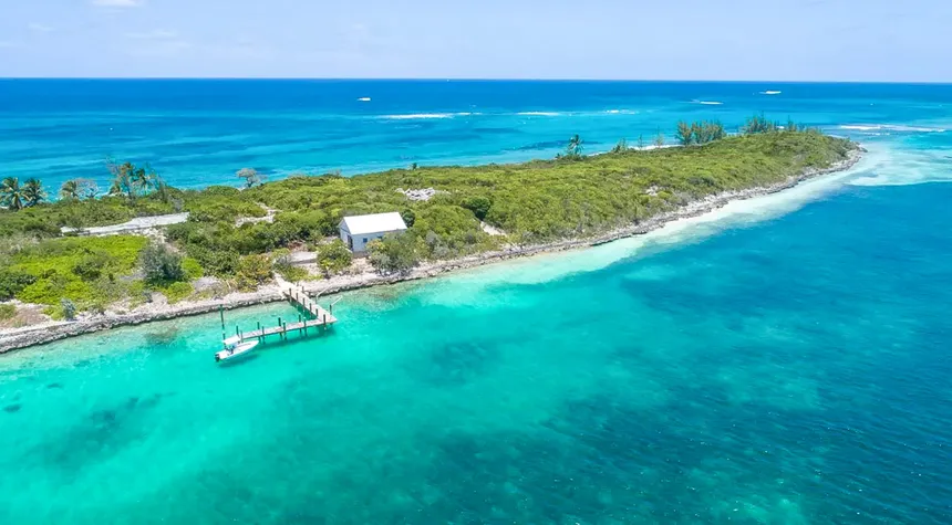
$4,950,000USD
Pierres Island
16-Acre Private Island, North Eleuthera, The Bahamas
Most private islands in the Bahamas are flat. Pierre Island is not.
The 16-acre property sits on elevated ground in **Three Islands Bay**, at the northern end of the Eleuthera archipelago, with 360-degree views across the bay to the Atlantic Ocean on one side and to the pink sand coast of Harbour Island on the other. The elevation matters. It is the difference between a beach property and a property with a horizon, and it is the reason a thoughtful buyer with a clear architectural vision can build something on Pierre Island that almost no other Bahamian island can offer.
Ten minutes by boat from Harbour Island. Less than 10 kilometres from North Eleuthera International Airport. Mainland electricity and water already piped to the property by underwater cable. This is the part of the Bahamas where the established luxury island market lives.
## The Property
Sixteen acres of freehold Bahamian island, lightly developed, primed for a major residence or boutique resort with significant existing infrastructure already in place.
The current improvements include:
- **Mainland electricity and freshwater**, supplied to the island by underwater cable from Eleuthera. This eliminates the need for solar arrays, desalination plants, generator-only power, or the kind of utility expenditure that typically runs into seven figures on undeveloped islands of this size.
- **A backup generator and water tank** for resilience during weather events
- A **storage building** for supplies and equipment
- A **substantial deep-water dock** on the south side of the island, capable of accommodating yachts and tenders
- A **new breakwater** under construction to further protect the southern anchorage
- **Paved pathways** running throughout the island, connecting the various viewpoints and beach access points
- **Gazebos and a waterfront bar**, with sweeping views across the bay and the Atlantic
- A **tennis court foundation**, already poured and ready for completion
- **150 mature coconut palms** distributed across the property, with the kind of canopy density that takes decades to establish from scratch
The combination of pre-installed mainland utilities, the dock, and the tennis-court-ready foundation means the next owner steps into a property that is genuinely ready for vertical construction rather than ground-up site preparation. For a Bahamian private island transaction, this is unusually advanced infrastructure.
## The Setting
**Three Islands Bay** is the protected stretch of water between North Eleuthera, Harbour Island, and the surrounding cays. Sheltered from the open Atlantic by Harbour Island to the east, with calm shallow water, white and pink sand bars at low tide, and the gentle current that has made this stretch of the Bahamas one of the world's most popular sailing and yachting destinations.
**Harbour Island**, locally known as **Briland**, is a 10-minute boat ride away. The island is famous for two things. The first is its **three-mile pink sand beach**, consistently ranked among the world's finest beaches, with the pale rose colour produced by microscopic red foraminifera shells mixed into the white sand. The second is the social and culinary calendar that has built up around Briland over the past four decades. Gourmet restaurants in restored colonial buildings. The Dunmore Town village with its weathered loyalist architecture. Tennis at the Coral Sands. The boutique hotels (the Dunmore, Pink Sands, Coral Sands, Ocean View) that anchor the island's particular brand of barefoot-elegant Bahamian luxury. India Hicks lives nearby, and Diane von Furstenberg has owned property on Briland for decades.
The point being: when you own Pierre Island, you have a private 16-acre estate with elevated 360-degree views, and you have one of the world's most celebrated small island societies a ten-minute boat ride away. Privacy at home, social life within reach.
**Spanish Wells**, ten minutes north by boat, is the second piece of the local character. Settled by the Eleutheran Adventurers in the 1640s, Spanish Wells is the longest continuously inhabited settlement in the Bahamas, with a working lobster fishing fleet, picture-postcard pastel cottages, and a tradition of small-boat seamanship that has shaped the local sailing culture for nearly four hundred years.
## North Eleuthera and the Wider Region
The **North Eleuthera mainland**, immediately adjacent, holds the airport and the gateway villages of Three Island Dock and Gene's Bay. Eleuthera island itself stretches 110 miles south from this point, a long narrow ribbon of pink-and-white sand beaches, hidden coves, the Glass Window Bridge where the Atlantic and the Caribbean meet at a single 30-foot-wide isthmus, the abandoned plantations of the cotton era, and the small, slow, distinct villages that have given Eleuthera its reputation as the most refined of the Out Islands.
For a buyer dividing time between a main residence and an island retreat, the configuration is exceptional:
- **North Eleuthera International Airport (ELH):** less than 10 kilometres from Pierre Island, with direct daily commercial flights to Miami, Fort Lauderdale, and Nassau, and a full-service **FBO for private aircraft**
- **From Miami:** approximately 75 minutes in the air
- **From New York or Toronto:** approximately 3 hours direct, or via connection through Miami or Nassau
- **From London or Europe:** through Nassau or Miami connections
A buyer leaving Manhattan or London in the morning is on Pierre Island for sundown.
## Development Considerations
The island carries clear scope for two distinct positions:
**A private estate.** A single main residence with guest houses, a working dock, and the existing tennis court completed, occupying perhaps 2 to 3 acres of the elevated central ground, with the remaining 13 to 14 acres maintained as a private nature reserve. The 360-degree views from the high ground are suitable for a single architecturally significant house in the style of the modern Bahamian estate work being done elsewhere in the Out Islands by firms like SCDA, Chad Oppenheim, or local Bahamian architectural practices.
**A boutique luxury resort.** The same 16 acres can carry a 15- to 20-villa boutique property in the manner of the Cove Eleuthera or Pink Sands on Briland itself, with the deep-water dock, the existing utility supply, and the proximity to North Eleuthera Airport all providing operational advantages that an undeveloped greenfield site would not.
A small-scale eco or glamping resort is also viable, leveraging the low-impact infrastructure already in place.
Standard Bahamian property law applies. Foreign buyers can hold freehold title directly through a Permit to Purchase from the Bahamian Investment Authority, which is granted as a matter of course for properties over a certain value threshold and supports the country's well-established expatriate-owner ecosystem.
## Access
- **By aircraft to North Eleuthera (ELH):** direct daily commercial service from Miami, Fort Lauderdale, and Nassau; private jet service through the airport's FBO
- **From the airport to the mainland boat dock:** approximately 5 minutes by car
- **From the mainland dock to Pierre Island:** approximately 5 to 10 minutes by boat
- **From Pierre Island to Harbour Island:** approximately 10 minutes by boat through Three Islands Bay
- **By private yacht:** the deep-water dock on the south side accommodates yachts; the new breakwater under construction will further improve mooring options
## The Position
Pierre Island sits at an unusually clean intersection of three things that rarely overlap in private island real estate: **established utility infrastructure** (eliminating the eight-figure off-grid build that derails many island projects before they begin), **commanding elevated views** (a structural rarity in the Bahamas), and **proximity to a globally recognised luxury island community** in Harbour Island. The 16-acre footprint is large enough for a significant private residence or a thoughtful boutique resort, and small enough to be maintained and operated by a household-scale team.
For a buyer who has been looking at Caribbean private islands and finding that most of them require either significant infrastructure investment, significant isolation, or significant compromise, Pierre Island offers an alternative position: a finished platform on which to build, at the doorstep of one of the most celebrated stretches of coastline in the Caribbean.
16 AcresFreehold
Listed 71 days ago

$2,100,000USD
Ilha Araçatiba
Angra dos Reis and Paraty, State of Rio de Janeiro, Brazil
Ilha Araçatiba, an island spanning an excess of 15 acres in the State of Rio de Janeiro, offers a main villa complete with seven air-conditioned suites, a family kitchen, a dining space, a TV and living room, a laundry room, a barbecue area, a sauna with bathroom and dressing room, a swimming pool, and an illuminated sports court. This home, and the island caretaker’s residence, are serviced by an electrical generator and a potable water source. Alongside developed comfort, Ilha Araçatiba provides ample fishing, hiking, and diving opportunities. A perfect pairing of indoor and outdoor leisure. All documentation is available and in order.
15.6 AcresInformation upon request
Listed 71 days ago

$2,100,000USD
Isla Las Bandurrias
Cochamó Commune, Las Rocas Lake, Chile
Encircled by snow-capped mountains and verdant hillsides, this island profiles as a remote sanctuary in the Chilean wilderness. Though undoubtedly disconnected from the monotony of city-bound life, the property still enjoys proximity to the settlements of Lago Puelo and Puerto Montt (20km and 110km, respectively). Deer, foxes, and a variety of birds are all native to the evergreen woodlands surrounding Las Rocas Lake. The nutrient-rich waters are also teeming with fish. There are two main structures on the island alongside tertiary buildings for utilities. The primary house comprises three bedrooms, two bathrooms, and a complete ensemble of communal spaces. A secondary cabin that can accommodate six residents is also present.
12.3 AcresFreehold
Listed 71 days ago

€2,500,000EUR
Στρογγυλό
Patmos, Kalymnos, Dodecanese, Aegean Sea, Greece
Spanning 54 acres within the blue waters of the Aegean Sea, Stroggilo Island presents itself as an ideal sanctuary for sailors and island hoppers. Stroggilo, or Strogylo as it is locally named, hosts generous anchorage alongside three natural beaches. These features foster curiosity as to the island’s development potential. While an old house and a well with groundwater currently sit in ruin on the property, future efforts to redevelop or expand would be subject to planning permission and approval from the relevant authorities. As such, diligent inquiries into Strogglio’s affairs would be recommended. Notwithstanding questions of Strogglio’s commercial availability, the property is attractively proximate to other recreational landmarks. The serene beach destination of Marathi is a short boat journey away and offers access to a selection of tavernas.
54 AcresFreehold
Listed 71 days ago

€9,750,000EUR
Killarainy Bay Beach, Kilbaha South, County Clare
Loop Head Clare, Clare, Ireland
This contemporary masterpiece sits on 60 acres, overlooking Dunmore Bay and a private island. With 3 reception rooms, 4 bedrooms, 4 bathrooms, and an indoor pool, it offers panoramic sea views extending to Loop Head Lighthouse and Kerry Head. Built to exacting standards, this home blends striking architecture with classical influences. Ornate decorative ceilings, a stone staircase with brass-coated balustrades, and exquisite Bossi chimneypieces merge seamlessly with modern design. A helipad, sea, and road access ensure convenience. Nearby amenities include Kilbaha Bay Harbour, Carrigaholt village, Kilkee, Kilrush, and access to Kerry. Electric gates lead to secure parking, an oval-shaped reception hall, a magnificent reception room, and a study with ocean views. The lower level features a pool room, ‘Champagne Room,’ and changing rooms. The master bedroom suite, two more bedroom suites, and a guest bedroom suite complete the picture, with a lovely courtyard, integral garaging, laundry, and back kitchen.
60 AcresFreehold
Listed 71 days ago

$9,500,000USD
Devils Cay
Berry Islands, Bahamas
Uninhabited save for sea turtles that frequent the island’s beaches and northern cove, Devil’s Cay is a pristine example of Bahamian splendour. The property spans 117 acres and is located near the centre of the Berry Islands chain. Having remained undeveloped, the island retains its diversity of habitat and environments – sand shores demarcate much of the property’s perimeter whilst dense vegetation covers the interior. Devils Cay also boasts a minor ridgeline along its western edge. Devils Cay’s location cannot be undervalued. The Berry Islands have become a serene refuge for many millionaires and real estate investors due to their natural beauty, abundance of aquatic life, and accommodation of leisure activities – residence here enters oneself into one of the world’s most exclusive communities.
120 AcresFreehold
Listed 71 days ago

$380,000USD
Isleta El Paraíso
Las Isletas de Granada, Lake Nicaragua
Roughly twenty-three thousand years ago, the northeast flank of the Mombacho volcano collapsed and slid, in a single catastrophic afternoon, into the lake at its feet. The debris travelled twelve kilometres before it stopped. When it did, the higher points of the avalanche remained above water as 365 small green hummocks, each one a former piece of the volcano's slope.
This is Las Isletas de Granada. The archipelago is among the most distinctive in the world, geologically speaking: an entire island chain that was once the side of a single mountain. The mountain itself, still active enough to vent sulfur from its summit fumaroles, looks down on the islets today from across the water. The colonial city of Granada, founded by the Spanish in 1524 and the oldest continuously inhabited European-founded settlement in mainland America, sits twenty minutes from the islets by boat.
Isleta El Paraíso, *the paradise*, is one of those 365 islets, available now.
## The Property
Approximately one acre of palm-shaded, lake-fringed Nicaraguan island, dressed in native flora and decorative gardens that have been thoughtfully integrated into the island's tropical character.
The improvements include:
- **Two bungalows**, comprising three bedrooms in total across both
- A **ranch-style outdoor pavilion**, suitable for dining, gathering, and the kind of long lake-front afternoon the islets are built for
- A **separate caretaker's house** for resident on-island staff
- **Piped electrical service** to the island
- A **large water storage tank** for freshwater supply
- All furnishings included with the sale
The arrangement is small but complete. A family can occupy the island as a primary or secondary residence with the existing infrastructure, and the caretaker's quarters allow year-round maintenance whether the owners are in residence or abroad.
## The Setting
Las Isletas de Granada is the rare private-island archipelago where the islands are a normal part of regional life rather than an isolated luxury enclave. The islets host a community of around 1,200 residents, including local Nicaraguan families, expatriates from the Americas and Europe, several boutique ecolodges and restaurants, a 16th-century Spanish fort, and even a small lakeshore school. Boats move between the islets the way cars move along a street in a small town. The everyday rhythm is gentle, neighbourly, and characteristically Nicaraguan.
What makes the position remarkable is the backdrop.
**Mombacho Volcano** rises 1,344 metres directly behind the archipelago, cloaked in cloud forest at its summit and protected as the Mombacho Volcano Nature Reserve. The reserve protects 457 plant species, 87 species of orchid, 186 bird species, and several creatures found nowhere else on earth, including the endemic Mombacho salamander and the Mombacho butterfly. Day hikes from Granada lead through the cloud forest to vantage points overlooking the islets and the lake.
**Lake Nicaragua (Lago Cocibolca)** is the largest lake in Central America, 8,264 square kilometres of fresh water, with **Ometepe Island** and its twin volcanoes visible on the horizon on clear days. The lake is one of only a small handful in the world that historically supported a freshwater shark population.
**Granada**, the colonial city, lies twenty minutes north by boat. The streets are cobblestoned, the cathedral pink, the architecture restored, and the restaurant scene one of the most refined in Central America. Cafés in colonial courtyards. Galleries in former merchant houses. A daily market that has been operating since before American independence.
**Masaya Volcano**, an active basaltic shield with a permanently glowing lava lake at the bottom of its main crater, lies 30 minutes inland. Night tours descend to the crater rim while the lava is visible.
**Managua International Airport** is approximately 45 minutes from Granada by car, with direct flights from Miami, Houston, Atlanta, Fort Lauderdale, Panama City, San José, Mexico City, and Madrid.
## A Day, In Sketch
Mornings on the islets begin with mist rising off the lake and the call of howler monkeys from the surrounding islands. Boats from Granada cross the water to the city's markets and back. Egrets and herons stalk the shallow water at the island's edge. Pelicans and cormorants wheel overhead. A family of mantled howler monkeys lives a few islets across.
Breakfast on the ranch pavilion. Coffee, fresh fruit, *gallo pinto* if the resident cook is preparing it. The lake mirror-flat in the early hours, the silhouette of Mombacho beginning to take shape as the cloud burns off.
The day is whatever the owners choose. A boat into Granada for lunch in a colonial courtyard. A hike up Mombacho's cloud forest trails. A kayak through the maze of channels between the neighbouring islets. A book in a hammock on a small private beach.
Late afternoon, the light over the water turns gold, and the volcano's profile darkens against the western sky. Dinner can be on the island or in Granada. The boat ride home in the dark, with the lights of the colonial city behind you and the silent dark of the lake ahead, is one of the experiences Las Isletas residents tend to mention first when describing why they live here.
## The Position for the Next Owner
This is the entry tier of the private-island market and is priced accordingly. A one-acre Nicaraguan island with two bungalows, a caretaker's residence, full utilities, and the geographic and cultural assets of the Granada region attached to it is one of the more accessible ways to acquire a freehold tropical island anywhere in the world.
The property is suitable as:
- A **primary residence** for a buyer relocating to or retiring in Nicaragua's most established expatriate region
- A **part-time or seasonal residence** for a buyer based in North America or Europe, with the caretaker maintaining the property during absences
- A **boutique vacation rental**, with two bungalows and the ranch pavilion already configured for hosting guests
- A **small ecolodge expansion** integrated with the existing tourism infrastructure of Las Isletas
Nicaragua welcomes foreign buyers under straightforward property law, with no nationality restrictions on private residential real estate ownership outside the autonomous coastal regions. A licensed Nicaraguan notary handles transfer, and a local property lawyer is recommended for any cross-border transaction.
## Access
- **From Managua's Augusto C. Sandino International Airport:** approximately 45 minutes by car to Granada
- **From Granada to Las Isletas:** approximately 15 to 20 minutes by panga (small motorboat) from Puerto Asese or one of the other lakefront marinas
- **From the islets boat docks to Isleta El Paraíso:** a short final crossing among the channels of the archipelago
A buyer arriving in Managua in the morning is on the island by lunch.
---
Las Isletas de Granada was a single volcano's slope before it became 365 islands. Now one of those islands, with two bungalows and an acre of palm shade and a view of where the original mountain stands, is for sale.
1 AcresInformation upon request
Listed 71 days ago
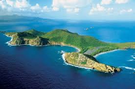
$120,000,000USD
Ronde Island
Grenadines Archipelago, Grenada
Ronde Island, the largest privately owned island in the Grenadines, has been on and off the market quietly since 2007. It is 2,000 acres in size, lightly inhabited, geologically distinctive, and one of the few remaining undeveloped large freehold islands in the eastern Caribbean. It is also positioned at the centre of one of the most acclaimed sailing regions on earth.
The island lies 5 miles north of Grenada, 15 miles south of Carriacou, and on the natural cruising line that connects Grenada to the Tobago Cays, Mustique, Bequia, and the other gems of the southern Grenadines. The Grenadines are currently under consideration for UNESCO World Heritage status across both Grenada and Saint Vincent jurisdictions, with the archipelago described in the nominating documentation as one of the most extensive coral reef habitats in the south-eastern Caribbean and one of the world's most popular sailing destinations.
This is the island at the heart of that archipelago.
## The Land
2,000 acres. Roughly 2.7 kilometres long by 1.5 kilometres wide. The terrain is the undulating Caribbean character that defined the island's earliest descriptions in 18th-century maritime charts: small hills rising to about 150 metres above sea level, narrow valleys, several sheltered bays, sandy beaches on the western flank, and rocky shorelines on the more exposed northern and eastern sides.
A **swim-through sea cave** at the island's edge is the property's most celebrated geological feature, a natural arch of black volcanic rock carved by centuries of Caribbean swell. The interior holds dry forest, scrub, cactus, and the kind of bird life that thrives where humans have largely stayed away: white and brown pelicans, frigates, herons, and migratory species using the island as a stopping point.
The island is presently uninhabited beyond a small caretaker presence and the seasonal use by Grenadian fishermen who anchor in the western bay during lobster season and other peak fishing periods, a traditional pattern that has continued for generations. Local fishermen maintain the only formal path on the island, a track running from the beach landing into the interior. This traditional use is part of the Grenadines maritime culture that any thoughtful future development would integrate rather than displace.
The island offers two primary development positions: **ridge-top sites** along the higher ground with 360-degree Caribbean views, or **beachfront sites** in the protected western bays with direct lagoon and reef access. The property is suitable for showcase villas or a boutique hotel, with scale appropriate for either model.
## The Underwater Landscape
The waters around Ronde Island are some of the most ecologically rich and dramatically structured in the Caribbean. Visibility regularly exceeds 100 feet. The marine fauna inventory includes:
- **Hawksbill and green sea turtles**, both nesting and resident
- **Large pelagic fish**: tuna, wahoo, marlin, and barracuda along the deeper drops
- **Green moray eels** in the reef crevices
- **Reef sharks** in the channels
- Resident schools of jack, snapper, grouper, and parrotfish
The underwater topography is the kind that brings dive operators from across the Caribbean to the area: **sunken cliffs and bottomless vertical walls** along the offshore drop, **coral-encrusted canyons**, and an **underwater cavern decorated with stalactites and quartz crystals** that is among the most distinctive geological features divers can visit in the region.
The Sisters Rocks, a small group of pinnacles just west of Ronde, are widely regarded as one of the finest snorkelling and shallow-dive sites in the southern Grenadines.
## Kick 'em Jenny
Eight kilometres west of Ronde Island lies **Kick 'em Jenny**, the only historically active submarine volcano in the Eastern Caribbean. Its summit is currently 180 metres below the sea surface, rising 1,300 metres from the seafloor. The volcano has erupted at least 14 times since 1939, most recently in April 2017, and is the most intensively monitored submarine geological feature in the Caribbean. A 1.5-kilometre maritime exclusion zone around the volcano summit is permanently in effect; a 5-kilometre exclusion zone is enforced during periods of heightened activity. Ronde Island lies well outside both zones.
A buyer considering Ronde Island should understand this geological context for two reasons. First, the entire Grenadines archipelago is volcanic in origin. The same forces that built the chain over the past three to four million years remain active in the region, and the visible character of the landscape (the offshore pinnacles of the Sisters, the dramatic underwater walls, the swim-through sea cave at Ronde) is the legible record of that history. Volcanism is not incidental to these islands; it is the source of their geological identity.
Second, the University of the West Indies Seismic Research Centre operates one of its permanent monitoring stations on Ronde Island itself, contributing real-time data to a regional warning system that has functioned reliably since 1939 and was significantly upgraded in 2025 with funding from the Caribbean Development Bank. Volcanic activity in the region is not visible or audible at the surface during most eruptions, and the science of detection and warning is more advanced here than at almost any comparable site in the world.
For a thoughtful buyer, the proximity to one of the world's most studied submarine volcanoes is either a feature of the position (active geology, unique marine life around the hydrothermal vents, ongoing scientific significance) or it is a fact to be incorporated into development planning. It is not a hidden risk. It is one of the reasons Ronde Island looks the way it does.
## The Grenadines Position
Ronde Island sits in the middle of what is widely considered one of the world's three or four finest sailing regions, alongside the Mediterranean's Cote d'Azur and Croatia's Dalmatian coast and the British Virgin Islands. The trade winds are steady, the water is clear, the islands are close enough together for short hops and far enough apart to feel discovered, and the cultural tapestry across the archipelago, from Grenada's spice plantations to the Tobago Cays Marine Park to Mustique's villas to Bequia's boatbuilding tradition, gives every sail a different character.
Sailing distances from Ronde Island:
- **Grenada main island:** 5 miles, less than an hour by yacht
- **Carriacou:** 15 miles, the cultural heart of the southern Grenadines
- **Tobago Cays:** 27 miles, a UNESCO-tentative-listed marine reserve and the archipelago's headline snorkelling and beach destination
- **Mustique:** 47 miles, the famously private celebrity island
- **St. Vincent:** 68 miles, the regional cultural and trading anchor
- **Barbados:** 140 miles east, with direct international flights from London, New York, and the European hubs
This is the strategic position: Ronde is not a destination in isolation; it is the **hub** of an entire Caribbean cruising region.
## Grenada and the Mainland
The main island of Grenada, five miles south, is among the most cultivated and historically rich of the Caribbean nations. Known as the **Spice Isle** for its nutmeg, cinnamon, clove, and cocoa plantations, with restored historic capital St. George's, the Port Louis International Luxury Yacht Marina, 45 beaches, the rainforests and waterfalls of Grand Etang National Park, and a cuisine and rum culture that has drawn the slow attention of international food writers over the past decade.
**Maurice Bishop International Airport (GND)**, on Grenada's southern coast, receives direct flights from London (Gatwick and Heathrow), New York, Miami, Atlanta, Toronto, and Frankfurt. From the airport to a boat dock for the crossing to Ronde Island is approximately one hour by road.
## Development Considerations
A 2,000-acre Caribbean private island of this scale is a once-per-generation type of asset, and the next chapter of Ronde Island will be defined by the position the next owner takes. Possible directions include:
**A private estate.** A compound house, a small villa for staff and guests, a private marina in the western bay, and the rest of the 2,000 acres left as a private nature reserve. The island is large enough that a complete personal residence occupies a tiny fraction of the land.
**A boutique hotel or private island resort.** Several ridge-top and beachfront sites can carry a low-density luxury hotel of 20 to 30 villas, in the style of Mustique's Cotton House or Petit St. Vincent's resort, without disturbing the character of the wider island.
**A conservation-aligned development.** Given the UNESCO World Heritage candidacy of the wider Grenadines archipelago, an environmentally led development with formal conservation partnerships could position the property as the flagship private island in the eastern Caribbean's most-watched marine region. The continuation of traditional fishing access in the western bay, formalised through a community access agreement, could be part of such a position rather than an obstacle to it.
**Mixed use.** The scale of the island is such that all three positions can coexist on different parts of the property.
Standard due diligence for a transaction of this scale should include verification of the freehold title chain, confirmation of any traditional or customary use rights, an environmental and marine impact assessment for any proposed development, and a survey of the seismic monitoring station's lease arrangement with the University of the West Indies. Grenada's property law is straightforward for international buyers and welcomes direct freehold purchase, with Grenadian citizenship-by-investment available under the country's CIP programme as an additional option for qualifying foreign nationals.
## Access
- **From Grenada main island:** approximately 5 miles by boat, less than 30 minutes by speedboat from St. George's or one of the northern Grenadian ports
- **From Maurice Bishop International Airport:** approximately one hour by car plus boat transfer
- **By private aircraft:** Maurice Bishop accommodates private jets to mid-size; helicopter transfer to the island can be arranged
- **By private yacht:** the western bay anchors comfortably up to 20 vessels and is one of the standard stops on the Grenada-to-Tobago-Cays cruising route
## The Position
The southern Caribbean's largest privately held private island, in the middle of one of the world's premier sailing archipelagos, at the geological centre of an active volcanic region whose character is written into every visible feature of the property. Ronde Island has been on the market sporadically for nearly two decades because there are very few buyers in the world for an asset of this scale and very few sellers willing to part with one. For the buyer who is both, this is the position.
2,000 AcresFreehold
Listed 71 days ago

$17,000,000USD
Katafanga Island
Lau Island Group, Fiji
The property serves as a testament to the natural splendour of the South Pacific: an encircling blue lagoon rich with fish and other marine life, pristine beaches, towering palm trees, and diverse interior vegetation. Given Katafanga’s size, there is significant potential for future development. The island could comfortably feature a first-class resort with the luxury addition of a private airstrip. The encompassing coral reef also has a natural 200-foot opening, allowing large yachts to berth near shore. At the time of its listing, there was one completed villa on the island, with another 19 partially built. A runway, golf course, ring roads, water jetties, and staff housing were also under construction. Those interested in Katafanga Island are urged to inquire about the current extent of its development.
225 AcresFreehold
Listed 71 days ago

$12,000,000USD
Nananu-i-cake
Ra Province, Fiji
In excess of 270 hectares of freehold land, Nananu-i-cake is one of the most naturally impressive islands on the Fijian market. By virtue of its size, the property offers a high degree of both peace and privacy. Though, these qualities do not come at the sacrifice of convenience and connectivity – Nananu-i-cake is located just a short distance from mainland Fiji and less than three hours from the country’s international airport. Initial development on the island comprised a traditional-style four-bedroom home with open-plan living spaces and panoramic views. With more recent refurbishments, the facilities now extend to two external cottages, a deepwater jetty, modern utilities, a luxury swimming pool, and livestock areas. With space to accommodate further commercial development, Nananu-i-cake presents an enticing opportunity for tourism entrepreneurs. The island would also excel as a private retreat.
575 AcresFreehold
Listed 71 days ago

$2,300,000USD
State of Bahia Private Island
State of Bahia, Rio Santarém River, Brazil
This property is situated in the county of Igrapiúna and is nestled within the Atlantic Forest and Mangrove Region. It boasts approximately 3,000 meters of beachfront and is adorned with over 2,000 coconut trees. The property features three houses. Although there is no public electricity on the island, some neighboring areas already have it. In addition, the island offers basic services like a health center, drugstores, banks, and supermarkets. It is also located near popular tourist destinations such as Boipeba, Barra Grande, Pratigi, and Itacaré. The most convenient way to reach the property is via the harbour of Ituberá, which is equipped with a runway.
25 AcresFreehold
Listed 71 days ago

A$2,500,000AUD
Ninth Island
Bass Strait, North Tasmania, Australia
If you have ever drunk a Tasmanian pinot from the Pipers Brook estate, you have already met this island. Ninth Island is the rocky outcrop the vineyard looks out on, twelve kilometres off the northern Tasmanian coast, and Tasmania's most celebrated cool-climate wine brand was named after it. The label is the view from the cellar door.
The island itself is now for sale.
## What It Is
Forty acres. 1.3 kilometres long, 550 metres at its widest. Freehold. One of only twelve freehold islands in the entire 5,000-island Tasmanian archipelago, which makes it among the rarest categories of land title in Australia.
Twelve kilometres north of Bridport, in the Bass Strait between Victoria and Tasmania. Accessible only by helicopter from the mainland, under a conservation covenant that has limited land traffic for decades and produced what is now an almost untouched piece of coastal Tasmania.
## The Wine Namesake
Ninth Island Wines is part of the Pipers Brook Vineyard portfolio, owned by Kreglinger, the Belgian family company founded in 1797 with registration number one in Antwerp. The label was created in the 1990s and has spent the last quarter-century carrying the island's name to wine lists across Australia, Europe, and Asia. Sparkling, pinot noir, chardonnay, pinot grigio, riesling.
Owning the island that gives its name to a globally distributed wine label is a position with no obvious second. It is a piece of branding history, of Tasmanian terroir history, and of the country's cool-climate wine story, condensed into one freehold title.
## The Wildlife
The conservation covenant exists for a reason. Ninth Island is one of the most biologically significant small islands in southern Australia.
- Over **1 percent of the global population of black-faced cormorants** nests here
- A breeding colony of an estimated **20,000 birds**, including short-tailed shearwaters and other native seabirds
- Resident **Australian fur seals** along the rocky shoreline
- **Little penguins** in burrows across the lower slopes
- **Bottlenose dolphins** in the surrounding waters year-round
For a buyer with a serious interest in conservation or ecotourism, the natural inventory here matches what some Australian states formally protect as nature reserves. For a private buyer simply wanting a wild estate, the island delivers that without any further effort.
## The Story
In August 1962, the MV *Sheerwater*, captained by Peter Donaldson, was wrecked on a reef off Ninth Island during a voyage from the Furneaux Islands carrying livestock to Launceston. The crew were rescued. Donaldson was the grandfather of Mary Donaldson, born in Hobart, who later became Crown Princess and then Queen Consort of Denmark.
The island's history holds other quieter things: a long period of light cattle grazing that has now ended, a 1995 oil spill from the MV *Iron Baron* that the local wildlife population has fully recovered from, and the long decades of being looked at rather than landed on. The Kreglinger vineyard owners held the title for many years before the most recent private ownership.
## The Setting
Ninth Island belongs to the Waterhouse Island Group, in a part of Bass Strait that is increasingly recognised as one of Australia's most refined leisure regions.
The mainland pier at Bridport is the closest point of contact, and Bridport is the gateway to **Barnbougle Dunes** and **Barnbougle Lost Farm**, two of the top three golf courses in Australia by national ranking, both designed on the dunes of the Tasmanian coastline directly opposite the island.
The Pipers Brook Estate is twenty minutes inland, with its cellar door, the Tamar Valley wine region around it, and over fifty other cool-climate vineyards within an hour's drive. Launceston, with international flight connections, is roughly an hour from Bridport by car.
## The Opportunity
A Development Application is currently in progress with the relevant local authorities, which is unusual for a Tasmanian island in this category and substantially de-risks the next owner's planning timeline. The land permitted for development sits above the Tidal Crown Land that surrounds the shoreline.
What can be built on the island has been the subject of several previous concepts:
- A **private residence**, with helicopter access, off-grid solar and rainwater systems, and a footprint sized to respect the wildlife covenant
- A **small-scale ecotourism operation**, with limited-capacity accommodation, in the manner of a high-end conservation retreat
- A **vineyard-aligned hospitality concept**, in partnership with the wine industry that already carries the island's name
The 360-degree views from the elevated land are widely considered the best of any island in the strait. The island sits high enough that the residence sites command the full sweep of Bass Strait, the Tasmanian coast to the south, and the open ocean to the north.
## Access
- **By helicopter:** approximately 15 minutes from Bridport or Launceston, landing on the island under the terms of the conservation covenant
- **By boat:** 12 kilometres from the mainland pier at Bridport, a roughly 30-minute crossing in suitable conditions
- **Launceston Airport to Bridport:** one hour by car, with direct flights to Melbourne, Sydney, and Brisbane
## What the Position Looks Like
Freehold private islands in Australia trade rarely. Ninth Island has changed hands twice in the past decade, and each transaction has been at a price comparable to a two- or three-bedroom apartment in an inner Sydney or Melbourne suburb. The arithmetic is what makes the listing distinctive: forty acres of legendary Tasmanian coastline, a national wine brand bearing the property's name, and a Development Application already in progress, at a number that would not buy a single floor in a Bondi tower.
For the buyer with an eye to Australian heritage assets, this is the rarest kind: a piece of land whose name has already been carried into the wider world, waiting for the next chapter to be written on it.
79 AcresFreehold
Listed 71 days ago

$5,500,000USD
Bulhaaholhi
South Ari Atoll, Maldives
This uninhabited island, located in the South Ari Atoll region, presents a prime property investment opportunity – for either private or commercial use. The 10-acre island presents all the greatest allures of life in the Maldives: white sand beaches, access to the cerulean waters of the Indian Ocean, verdant flora, and an abundance of sun exposure. Numerous proven resorts are located on the encompassing islands, proving the area’s viability for commercial usage. However, an income-generating property is not essential here. Should an investor want complete privacy, Virgin Island is perfectly suited for an isolated residence. Here, regardless of function, serenity awaits.
10.37 AcresLeasehold (50y)
Listed 71 days ago

$1,650,000USD
Fondeado Island
Honda Bay, Puerto Princesa City, Philippines
Introducing Long Beach Island, a stunning 10-hectare paradise located in the pristine waters of Honda Bay, Puerto Princesa City, Palawan, Philippines. This remarkable island offers a unique blend of natural beauty and serene luxury, perfect for those looking to escape to their own private haven. Long Beach Island stretches over a generous expanse, providing ample space for relaxation, exploration, and the creation of unforgettable memories. Its location in Honda Bay, renowned for its crystal-clear waters and vibrant marine life, makes it an ideal spot for water enthusiasts and nature lovers alike. This island’s charm lies not just in its size but also in its natural landscape, featuring lush vegetation and an unspoiled environment that promises peace and tranquility. The gentle lapping of the waves against the shore, the soft sands underfoot, and the warm, tropical climate all combine to create a setting of idyllic beauty. What sets Long Beach Island apart is its accessibility, coupled with the feeling of being worlds away from the hustle and bustle of city life. It’s a rare opportunity to invest in a place where time slows down, and life’s simple pleasures can be savored.
24.2 AcresLeasehold
Listed 71 days ago

$50,000,000USD
Petalas
Echinades Archipelago, Ionian Sea, Greece
In the second book of the *Iliad*, Homer lists the ships that sailed for Troy. From a place called Dulichium, in a chain of islands he calls sacred, Meges son of Phyleus brought forty. The *Odyssey* returns to Dulichium repeatedly: a kingdom rich in wheat and grass, ruled by Acastus, the homeland of Penelope's most courteous suitor Amphinomus, and the source of fifty-two of the suitors who occupied Odysseus's palace during his absence.
Where was Dulichium? Scholars have argued the question for two and a half thousand years.
The British topographer William Martin Leake, surveying the western coast of Greece in the 19th century, proposed an answer. He identified Dulichium with the largest of the Echinades, an island called **Petalas**, on the basis of three things: its size, its two well-sheltered natural harbours, and its position opposite the fertile alluvial plains of the Achelous river, which would account for Homer's "wheat-bearing" epithets. Strabo, and most modern authors, prefer the nearby island of Makri. The debate is genuine and ongoing. What is not in dispute is that Petalas is the largest island in the Echinades, that it is one of a small number of candidates for Homeric Dulichium, and that for two and a half thousand years it has been part of a maritime geography sung in the foundational poem of European literature.
It is also the largest privately-owned island in Greece, and it is for sale.
## The Land
Petalas covers approximately **5.5 square kilometres (1,335 acres)**, rising to a maximum elevation of **251 metres** above sea level. The island sits in the Ionian Sea, between the western coast of mainland Greece and the larger Ionian islands of Cephalonia and Ithaca, at the geographical centre of what Homer called the Ionian maritime network.
The landscape is the classical Mediterranean idiom in its purest form. Low scrub on the rocky higher ground. White limestone cliffs and beaches along the coast. **Approximately 4,000 olive trees** distributed across the cultivable land, an agricultural inheritance built up over generations and the kind of established Mediterranean canopy that simply cannot be created from scratch within a single human lifetime. Native pine, wild thyme, oregano, and the sage-and-rock-rose perfume that has scented this coast since the Bronze Age.
**Two well-sheltered natural harbours**, the same harbours Leake noted in the 19th century as the basis for his Dulichium identification. Several sandy beaches, small bays, and natural anchorages. Winding coastline that opens new vantages every few hundred metres.
The seasonal settlement on the eastern shore is the only built footprint on the island. There are no roads, no electricity infrastructure, no water mains, and no permanent residents. The island has been kept this way intentionally for decades.
## The Setting
The Echinades archipelago takes its name from **ἐχῖνος** (*echinos*), the Greek word for sea urchin, for the sharp, prickly outlines of the islands as seen from the sea. The chain is divided into three groups: the Drakoneres in the north, the Modia in the middle, and the Ouniades in the south. Petalas sits within the Ouniades, the southern group.
**The mainland is two kilometres east**, at the small harbour of **Platygiali Port near Astakos**, in the Etoloakarnania region of Western Greece. This is one of the rare private islands in the Mediterranean whose mainland is genuinely close at hand: a ten-minute boat ride, not an open-water crossing.
**Cephalonia and Ithaca**, the Ionian islands of Odysseus's home kingdom, lie to the west and north-west. Both are easily reached by yacht. **Lefkada** and **Zakynthos** lie further north and south respectively. Together these four islands and the surrounding archipelagos comprise one of the world's most celebrated cruising regions, where the same waters that carried Homer's heroes now carry the summer charter fleets of the Mediterranean elite.
**The Achelous river delta**, two kilometres east of Petalas on the mainland, is among the most ecologically significant wetlands in Greece, with the protected lagoons of the Mesolongi National Park supporting migratory bird populations and a quiet, slow-developing rural Greek coast that has preserved a genuine sense of the country's older agricultural character.
## The Neighbours
A note worth knowing. The wider Echinades archipelago is in the early stages of becoming the most distinguished private-island region in the Mediterranean. **Six of the surrounding islands**, including the larger Oxeia, were purchased in recent years by **Sheikh Hamad bin Khalifa Al-Thani**, the former emir of Qatar, for a reported sum of £7.3 million sterling. The wider region is increasingly being acquired by sovereign and private buyers attracted by the combination of Homeric geography, sailing access, and the rare combination of large freehold acreage with mainland European proximity.
A buyer of Petalas joins this small and growing cohort, with the position of the largest private island in the country.
## The Battle of Lepanto
The waters around the Echinades hold one of the most consequential naval battles in European history. On 7 October 1571, the Christian Holy League and the Ottoman Empire fought the **Battle of Lepanto** at the eastern entrance to the Gulf of Patras, a few nautical miles south of these islands. The Holy League's victory checked Ottoman naval expansion in the Mediterranean for a generation. Among the wounded was the young **Miguel de Cervantes**, who lost the use of his left hand in the battle and went on to write *Don Quixote*. The Venetians referred to the Echinades for centuries afterward as the *Curzolari*, after the islands closest to the battle site.
Owning an island that overlooks both the geography of the Trojan War's outgoing fleet and the site of the Christian-Ottoman struggle for the Mediterranean is a position that does not exist anywhere else in private real estate.
## Development Considerations
The Greek planning environment for private islands has historically been complex, and Petalas's development scope reflects a property that has been kept thoughtful and patient through that complexity.
**5,100,000 square metres** of the island's total **5,400,000 square metres** have been **declassified by the Greek Forestry Bureau**, a designation that opens the path to future construction subject to the standard regional planning approvals. Within the declassified area, there is established precedent for the parcelling of land into **10,000-square-metre lots, each accommodating a 130-square-metre principal residence**. This precedent does not guarantee specific approvals for a given project, but it establishes the framework within which a future development plan would be evaluated.
What this means in practice for the next owner is that a private estate, a discreet boutique resort, or a small low-density villa community is each viable under Greek law, with the legal and forestry groundwork meaningfully more advanced than is typical for Greek private islands of this scale.
The island's ownership is currently approximately **85% held by the Tsaoussis family** through Petalas Corporation SA, with the remaining **15% held by the municipal entity of Cephalonia**. Due diligence for the transaction includes the full title chain, the consolidation of ownership through the transaction structure, and the standard Greek property and forestry compliance documentation.
## A Note on Greek Ownership
Greece is a member of the European Union, and **EU citizens** purchase Greek property on the same terms as Greek nationals. **Non-EU buyers** are also welcome to acquire Greek property, with the additional pathway of the **Greek Golden Visa** programme available to qualifying investors. A licensed Greek property lawyer should structure any transaction of this scale before deposit.
## Access
- **By aircraft to Athens International Airport (ATH):** the principal international gateway, with direct flights from every major European hub, plus New York, Dubai, Singapore, and Beijing
- **From Athens to Astakos:** approximately 3.5 hours by car, or by short domestic transfer to Aktion Airport (PVK) near Preveza, followed by a 90-minute drive
- **From Astakos / Platygiali Port to Petalas:** approximately 10 minutes by boat
- **By private yacht:** the two natural harbours accommodate yachts of significant size; the island is on the standard Ionian summer cruising route
## The Position
Petalas is the property that does not exist anywhere else. It is the largest private island in Greece. It is a credible candidate for Homer's Dulichium. It overlooks the site of the Battle of Lepanto. It has 4,000 olive trees, two natural harbours, and 5.1 million square metres of declassified land available for thoughtful development. It is two kilometres from a mainland European harbour, and ten minutes by boat from a working Greek coastal village.
For the buyer with both the means and the temperament for a project of this kind, Petalas is the position from which to make a significant cultural statement in private Mediterranean real estate, in a region that the global ultra-wealthy are only just beginning to recognise.
Homer is the foundation of the European literary tradition. To own a serious candidate for the home of one of his named kingdoms is to step into a frame of reference that money alone does not usually buy.
1,335 AcresFreehold
Listed 71 days ago

$4,500,000USD
Isla San Jose, Boca Chica
Chiriquí Province, Boca Chica, Panama
Another island trio, these connected properties offer white-sand beaches, native forestland, abundant land and marine life, and pockets of developable land. The three entities, comprised of a main island (16 hectares) and two smaller plots (3.3 hectares and 1.3 hectares, respectively), combine for a total of 20 hectares and are located just off the limb of Boca Brava – one of Chiriquí Province’s largest islands. Not only are the islands themselves natural havens, but they also stand to serve as a gateway to the landscapes beyond. The waters surrounding San José are noted for their marine diversity, with adult humpback whales and their young migrating along the coast between September and November. The nearby mainland also shines as a hub for outdoor adventure, offering activities such as hiking, rafting, climbing, and ziplining. As gateways to Panama’s great outdoors or as private sanctums, the San José trio make an attractive pitch to prospective investors.
50 AcresInformation upon request
Listed 71 days ago

$4,900,000USD
Rose Cay
Roatan, Honduras
With crystal-clear waters, white sandy beaches, and lush vegetation, Rose Cay Island delivers a blueprint for tropical luxury. The 67-acre property is conveniently located just 200 metres from Roatán, granting it subsequent proximity to the Juan Manuel Gálvez International Airport. This position makes it an ideal space for private villas, an eco-resort, or an elegant residential community. Flush with lush rainforests and rolling hills to uncorrupted beaches and marine-rich waters, Honduras is a utopia for those seeking a closer connection with nature. Rose Cay beckons as a gateway to it all.
67 AcresFreehold
Listed 71 days ago

$25,000,000USD
Pumpkin Island
Southern Great Barrier Reef, Australia
In 1961, an oyster farmer named Snigger Findlay sat down to a card game in central Queensland and stood up sixty pounds lighter, without his island. Roger Mason walked away with the deeds. Pumpkin Island opened to its first paying guests three years later, and has changed hands exactly once since then. It is on the market now for the second time in sixty-five years.
This is not the usual rhythm of luxury real estate. Pumpkin Island has been held, not traded.
## The Setting
Six hectares, fifteen acres, in the Keppel Group of the Southern Great Barrier Reef. Fourteen kilometres off the coast at Yeppoon. Ten kilometres north of Great Keppel Island. Shaped like a boot, 150 metres wide and 450 metres long, with sandy beaches on every face and the warm twenty-five degree water of the southern reef around all of it.
The Great Barrier Reef is one of the seven natural wonders of the world. The southern reef is the quieter end, less travelled than the famous Whitsundays to the north, but every bit as biologically extraordinary. Humpback whales pass through the channel between Pumpkin and the mainland on their migration each year from June to November. Green turtles and hawksbills nest on the beaches. Dolphins are resident. The reef itself, twenty minutes by boat, is reachable on a glass-bottom kayak from your own jetty.
The wildlife on land is gentler. Sea eagles overhead. Small lizards and butterflies in the grass. Coastal she-oaks for windbreak. The island is small enough to walk in twenty minutes, and varied enough that no walk repeats itself.
## The Resort
Seven self-contained units, sleeping up to 34 guests:
- **Five oceanfront cottages**, each with a private deck looking out across the reef
- **Two beach bungalows**, with open-air kitchen and bathroom facilities
A central licensed beachfront bar and sunset lounge with a library, fire pit, and activities hut. A children's playground. A manager's residence. A separate staff guesthouse. A helipad. The whole compound has been built with the eye of operators who have run the island as their home as well as their business.
The resort is currently a fully operational, profitable business. The hand-over is end-to-end: keys, staff relationships, bookings, brand, supplier contracts, and the operating systems built up over two decades.
## The Sustainability Position
In 2018 the World Boutique Hotel Awards in London named Pumpkin Island Australasia's Most Sustainable Hotel. That citation is the headline, but the substance behind it is what matters. The resort runs entirely off-grid on wind and solar power, with rainwater harvesting and storage for all freshwater use. It was the first island in Australia to operate beyond carbon neutral, offsetting roughly 150 percent of its emissions and producing a small net climate benefit each year.
For a buyer with a thesis about the direction of luxury hospitality, that position is the moat. A new resort can build a carbon-neutral compound. It cannot retroactively claim to have been the first.
## The Business and the Assets
Included in the sale:
- The freehold of all improvements and the leasehold of the land to 2046, after which the lease becomes a rolling renewal
- **Pumpkin Xpress**, a custom-built 36-passenger passenger ferry, the resort's branded transport from Keppel Bay Marina
- Three registered boat moorings
- An active oyster lease (guests still shuck their own oysters off the rocks at low tide, which is exactly the kind of detail Pumpkin Island is known for)
- Helipad and existing helicopter charter relationships from Rockhampton
- Planning approval already secured for two additional villas, with capacity expansion immediately available to a new owner
- Full operating brand, website, booking systems, supplier relationships, and Sojourn Retreats management knowledge
The 2012 to 2015 chapter, when the resort was temporarily rebranded as XXXX Island for a national beer campaign, is a part of the property's place in Australian cultural memory. Three thousand prize winners visited during the promotion. The story is repeated affectionately enough by Australians of a certain age that mentioning the island still triggers recognition.
## Access
- **Rockhampton Airport** is a 45-minute drive from Keppel Bay Marina at Yeppoon, with direct flights from Brisbane, Sydney, and Melbourne
- **Keppel Bay Marina to Pumpkin Island** is a 45-minute crossing on the Pumpkin Xpress, or a charter boat, or a helicopter direct to the helipad
- **Helicopter from Rockhampton** is approximately 25 minutes door to door
For a buyer flying into Sydney or Melbourne in the morning, the island is reachable by dinner the same day.
## The Position for the Next Owner
Pumpkin Island is at a clean transition point. The current ownership family is moving to New Zealand. The resort is profitable, award-winning, brand-recognised, and structurally complete. The planning approval for two additional villas, the unactivated wellness and dining upsell categories, and the long runway of the sustainability story all give a thoughtful new owner room to grow without disturbing what already works.
Six hectares of the Great Barrier Reef, with one of Australia's most respected eco-tourism operations attached, comes to the market roughly once every three decades. Snigger Findlay played his cards. The next owner gets the better deal.
16 AcresLeasehold
Listed 71 days ago